
It’s Monday 3:20am and I’m lying awake with my mind buzzing from the weekend. Thoughts flying in from all directions about the course, the highs and lows, the people and my achievement. My body feels sore with the DOMS rearing its head as a reminder of quite how much I battered myself. Even while typing this my left big toe is throbbing and at a brief glance it’s looking rather red.
I’ll be completely open in saying this is the toughest challenge I’ve undertaken since dipping my toe (not my sore one) into the world of 50KM ultra running. Until this point, the SwissAlps 100 (50KM) held that title since 2022. So what made it so challenging for me? The gradient. Look at the profile below, it resembles the side view of a few sharks teeth laid next to each other.
It’s worth noting that this was my second attempt at the course after returning home last year with my tail between my legs from a DNF. I wasn’t truly trained for the gradient and quite honestly was complacent. Oh, how I learned my lesson. My write-up is here if you’re interested and it has different photos as I didn’t want to duplicate them below. Anyway, that said, let’s begin.
The forecast was good for the weekend and the organizers invoked the addition of their ‘Hot Weather’ kit list to the ‘Mandatory’ kit list which, to be honest I was taking anyway. Suncream, sunglasses, additional 1 litre water carrying capacity, etc… The 50KM start was staggered into three waves, the first of which at 08:30 then 08:45 and finally 09:00. Your wave is decided by your UTMB index with the idea being the faster runners start soonest. In the lead up to the departure of each wave there’s a 4 minute tribal drum rendition from Batala Bangor to get the runners and crowd pumped. My start was at 08:45.
Launching out of the start gate to a round of cheering our wave set off out of the town. Initially, our wave was packed tightly together while we navigated the road to the entrance of the Llanberis Path, the first of many ascents.
With a wider path the jostling for position calmed down as people found their rhythm and stride. Recalling what was in store I grabbed my poles to take the load off my legs and focussed on the route ahead occasionally glancing around to appreciated the scenery – which is stunning.
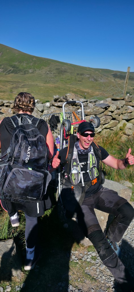
I happened to see this guy, sat by the edge of the path. Yes, that is a shopping trolley and it’s being filled with rubbish found on the track that’s been carelessly discarded.
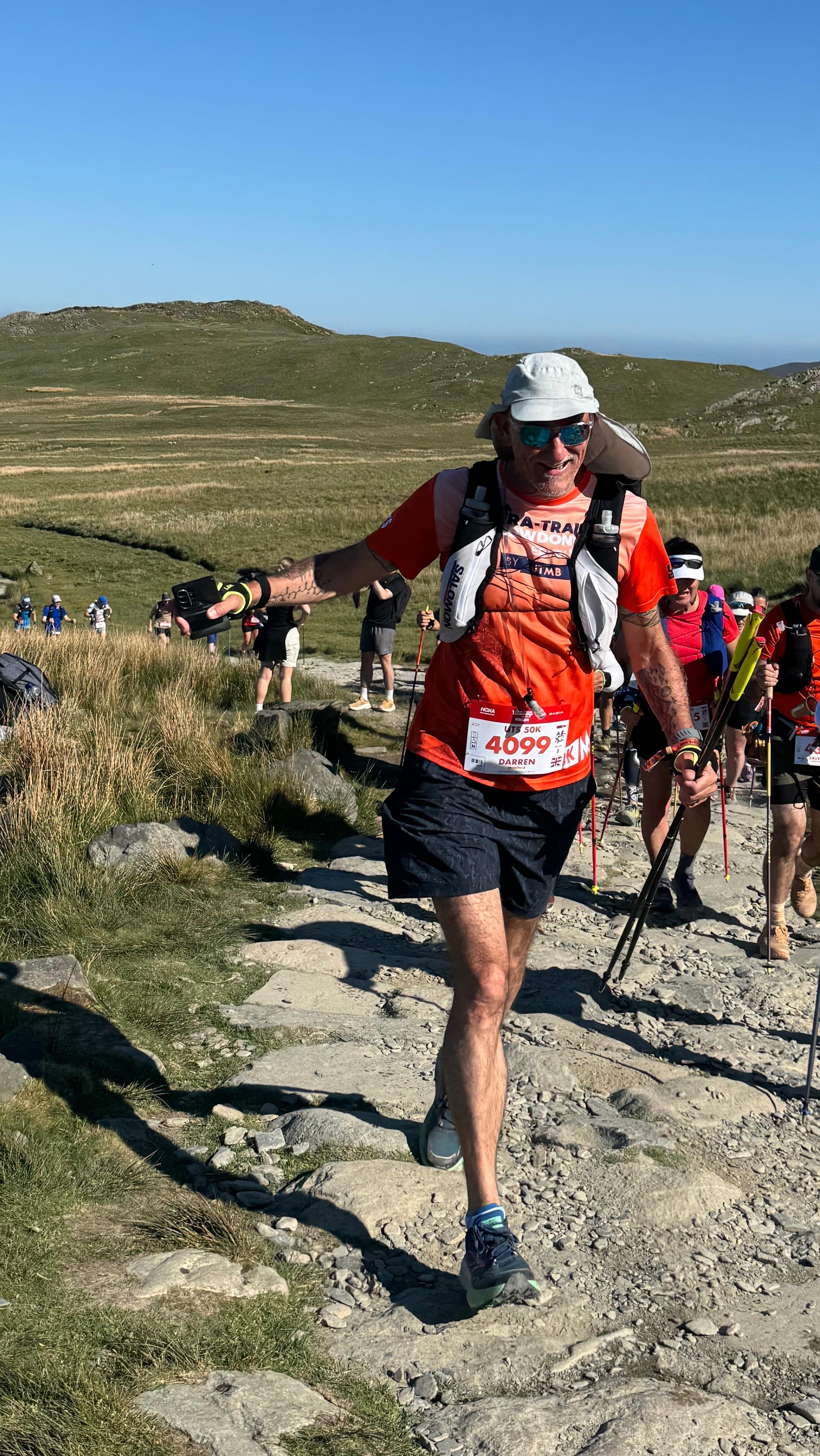
My wife aka, chief supporter, race director, nutritionist and physician was positioned further up the track to cheer me on and grab some photos.
Small pockets of tourists who were out for the day occasionally offered words of encouragement which I (always) acknowledged and reciprocated as it’s not a walk in the park getting to the top of Snowdon.
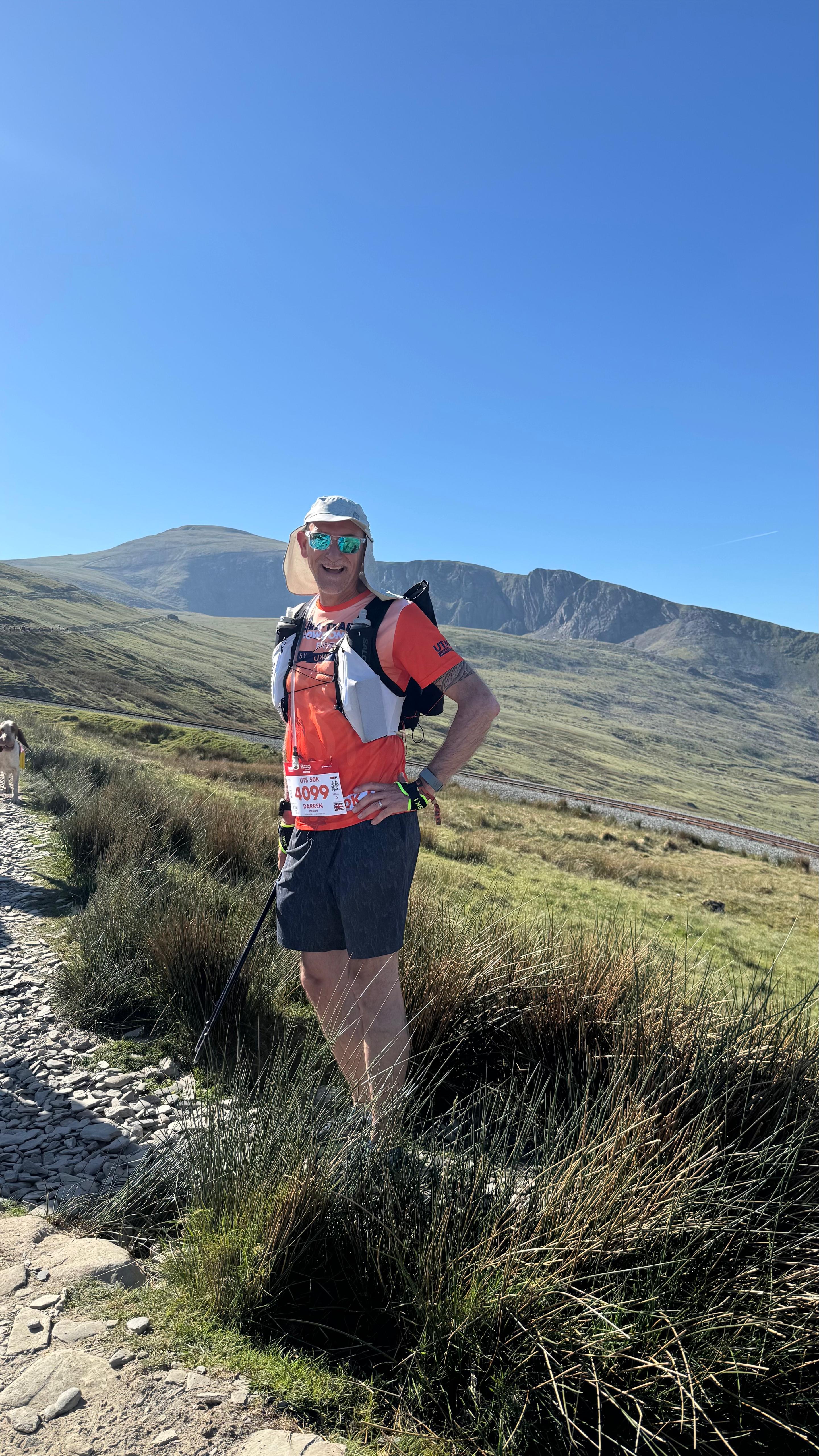
Nearing the point of where the route was about to change I turned back to admire the view and observe the steady stream of runners behind.
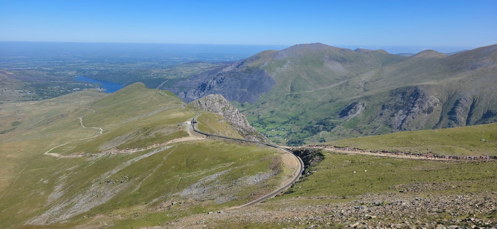
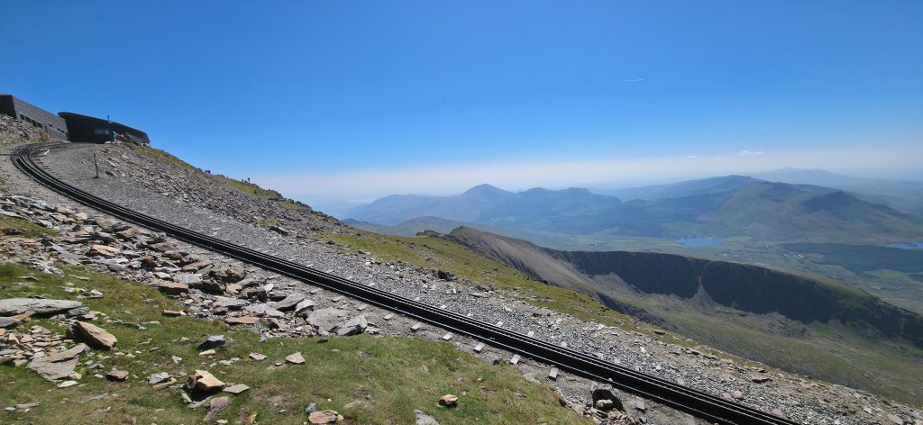
The endless climbing on a relatively even terrain eventually ceased upon reaching the Pyg Trail, this signals the first of a gradient change. I stashed my poles and prepared myself for the descent towards Pen-Y-Pass. Looking down the trail it looks quite innocuous – the photo doesn’t reveal the true gradient and make up of the path. The scenic view is beautiful from here.

This section is formed of large rocks strategically placed between areas of natural formation however, there’s nothing consistent in the spacing, height and width. Some runners have no fear and oodles of confidence to rush down skipping effortlessly past me at times. While I try my best to follow I spend a lot of time picking my way down. After negotiating the top half of the trail the gradient begins to ease and paths begin to return in between occasional sections of natural rock formation that not even the most experienced runners can skip across. Basically, it’s time to use your hands and scrambling your way around. Now, while the rocks and finding a route down aren’t challenging enough there’s also the groups of walkers on their way up to Snowdon. For the most part people graciously waited to one side as we descended cheering us on.
Reaching Pen-Y-Pass I was about 25 minutes ahead of last year’s arrival time and I felt good. I’d been focussing heavily on keeping fuelled and hydrated in the past 2.5 hours. The gradient began to ease which meant I had the confidence to pick up the pace and run for most of the way to the first aid station. Unlike last year, I was focused on my aid station cut-offs this time around and left Gwastadanas Farm at 11:55, with 50 minutes in hand.
The next section tracked alongside the Llyn Llydaw lake and while on the profile map it looks even it’s not exactly that. A mixture of grass tracks, rock trails, root sections, low trees, fallen trees, stiles… it’s all there! The pockets of shade were a relief as the sky was clear with the sun shining strong. It was hot and unlike the previous mountain section there was no cool breeze.
Arriving to a small road (A498) where a car park and (a tempting) cafe were the route turned abruptly upwards into the woods following the Cambrian Way. More shade was welcome and I was able to trot along as the gradient wasn’t too severe at times. I knew what lay ahead for the next section so I paced myself a little.
Underfoot it was easy going with the track resembling a fire road with pockets of natural rock that were easily walked up and over. I used my poles as the gradient was now returning. To my right the waterfalls flowed with groups of people enjoying the cool water, jumping into pools and generally relaxing – damn them having a good time! 😀
The Cambrian Way rapidly changes its gradient once the grass section ends and the shale begins. The runners I’m in lock step with have their poles out too and we’re a small train of ants zig-zagging our way up passing people on their way down – some more graceful than others it has to be said. There’s no one single route up either in this section and I could hear the occasional comment (think loud exclamations of frustration) from others around me as they tried a different angle of attack. I had the occasional slip and slide but with poles to stablise me I found my way.
Leaving the shale behind the mountain presented its next challenge. Scrambling, lots of it. The previous write-up I mentioned at the start of this blog post has a photo showing just one of the many obstacles to negotiate. Finding my way over rock while still holding my poles all the while listening to the heavy breathing and footfalls behind me I found quite distracting. Am I holding people up? In the end I just kept to my pace and occasionally pulled over. Some people passed while others said they were fine, “…there’s no rush”. Really, there wasn’t. It was steep and very windy. The Cambrian Way follows the ridge line too so keeping an eye on where you’re going and in a controlled manner is a good plan for everyone’s sake.
Eventually, I summit Snowdon.

Here’s the view looking back to the ridge line I’ve spent quite some time plodding up.
At the summit it’s packed full of people, jam packed. There’s so many in fact that it’s difficult to find a route through and across the rock strewn path. After getting past the cafe and queues of people wanting to touch the trig point I see a gigantic UAE Flag laid out to one side on the ground surrounded by a group of very happy and cheering people.
It’s now 14:50. I’ve covered 26KM and accumulated just over 2000m of height gain and it’s time to descend, the next aid station has a cut off of 16:45. Looking down I can see a bright white marquee and sun glinting off the car windows. According to my notes I just need to follow the Rhyd-Ddu Path that’s 6KM away, I feel confident I’ll make the next checkpoint in time.
The route down is still rocky with a myriad of switchbacks, small drops and gullies and I used my poles for support. My feet were beginning to feel tired from the relentless bashing of hard stone and my toes were getting a little uncomfortable from constantly hitting the inside of my shoe when overcoming the steep parts. The route veers off the track and across a large green field that’s slightly boggy. In comparison to all other gradients this seems level and it’s soft, such a relief. The route joined a track and into a fire road, ducked into a small tunnel under a minor tarmac road then the aid station of Bron-y-Fedw Uchaf was in front of me. Fantastic. Last year my race ended here. This year, I had 40 minutes to spare before the cut-off. I took the opportunity to fill up on water and grab something to eat.
Officially, I was 32.4KM into the race with exactly 24KM remaining. I felt comfortable and was looking forward to beginning the next section in the woods. Shade was definitely needed.
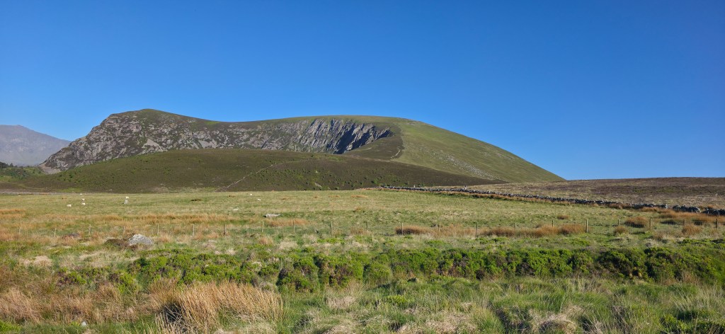
The shade didn’t last too long before my next challenge lay ahead, in the form of a mountain called Mynydd Mawr. My friend Sean (https://www.instagram.com/trailrunforlife/) previously explained the blind summits of this so I knew what to expect but knowing and experiencing are two different things! Looking up ahead and as far as my eye could see I was able to make out small dots of people in the distance. Oh well.
There was no breeze and the oppressive relentless power of the sun returned. I grabbed my poles once again and set off at a comfortable walking pace although it wasn’t long before I reached the first of many steep sections. I found these to be quite draining and the exertion was affecting me more than I realised until at one point I literally had to move to one side and sit down. My vision went a bit strange and I couldn’t properly focus then I felt slightly nauseous. I remained still for a few minutes, closed my eyes and focused on composing myself. I continued to sip water. As brief as the stop was the zoning out really helped. I conceded from this point that I needed to really slow down the pace in order for me to continue.
While seated and feeling much better I could appreciate this view. The aid station was clearly in sight and I could track back the route I’d been following for the past hours, reminding myself I was doing ok.

I set off and chose a purposeful one foot in front of the other pace while climbing and zig-zagging slowly over and around the obstacles. I made frequent stops and continued to hydrate and eventually reached the summit. Golly, I felt broken. The race marshals said it was only 2KM to the next aid station although I wasn’t convinced. My notes said it was 4.1KM so I put this down to them simply reassuring myself and the other runners that we weren’t far from our next stop.
The route down off the mountain was simple underfoot but quite steep so my feet were back to bashing the front of my shoes. Eventually, the terrain levelled out across some farmland with simple tracks that I weaved down through to the Bryn Gloch campsite at Betws Garmon for the final aid station. The cut-off was 19:00 and I’d arrived with 25 minutes to spare. I spent time seeking out some fruit and found my favourite recovery item, watermelon! Oh joy. I stood by the table and inhaled piece after piece – it was refreshing and delicious all at the same time. Upon leaving the area I was offered cold water for cooling down so I made use of a large tub of water and soaked my cap in it.
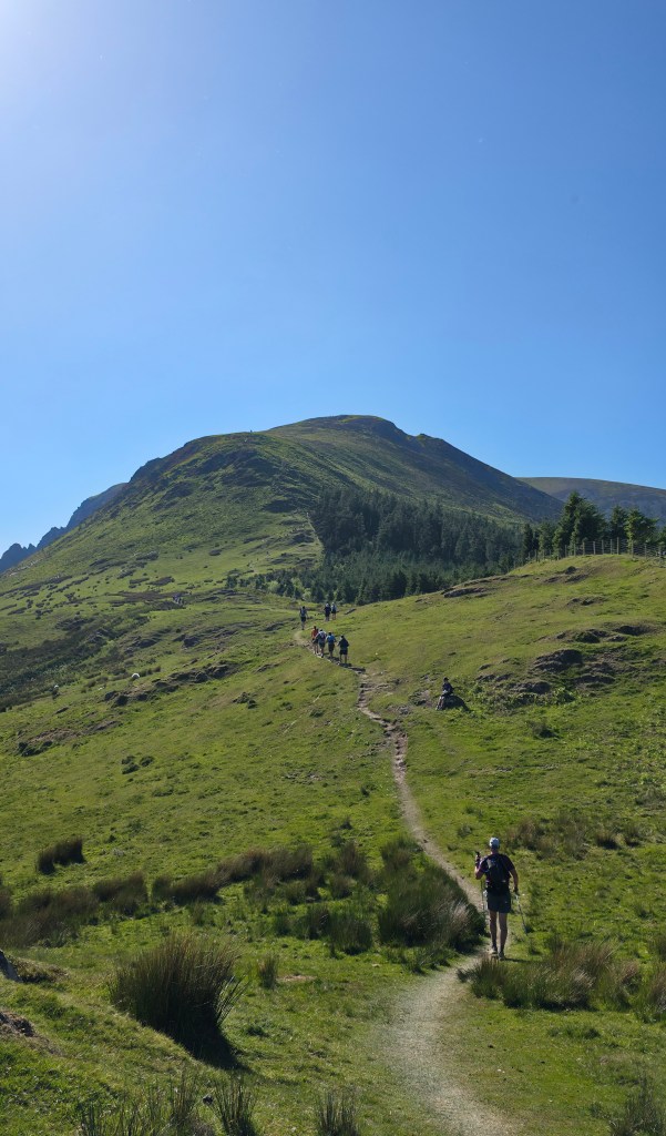
Now it was the final push. I had 16KM left to the finish line and 4 hours 15 minutes in which to do it. Oh, and one final mountain stood in my way. Leaving the aid station I headed back into the foothills via a couple of fields. Shortly after the fields were replaced with a dense forest and the group of runners I was in cadence with entered it. The local forestry commission had been in there working so there were no paths visible other than trampled areas from previous runners. The felled trees still had their branches attached which meant they often snagged on my shoes and scraped my legs. It was an arduous slog through the first part of the fallen forest. With the disaster zone left behind and a short time in a normal woodland environment the route found its way back onto narrow tracks in the open grazing lands. I was climbing slowly as the route circled the lower part of the mountain before abruptly turning in and revealing a long winding track up ahead. I could see my route along the ridge line with runners on it, it was time to start digging deep again.
Out came the poles and I resumed my slow pacing to get me up to the summit. I reminded myself that every step mattered to getting closer, closer to the finish line. The wind had returned and while the sun was still shining I was beginning to feel a chill in the air. Some runners paused to put on another layer but I held off as I expected the climbing would really heat me up again, and it did. For the next 45 minutes I crept up to the summit and occasionally I could hear the energy from the event village as the sound travelled up through the valley. So tantalising close!
Finally, I’d reached the summit where a marshal told me it was only 8KM to the end and two small inclines to get past. The view from there was amazing as the sun reflected on sea.

The first descent was steep and my feet were really feeling painful. The first of the two inclines came into view so I grabbed the poles and resumed my slow pacing up. Down the other side I could see the final incline, it looked worse than the one I’d just managed to get over! Once again, a sharp descent reminded me that my feet were very unhappy.
As I traversed toward the final incline there was a runner is a very poor way, surrounded by four runners putting him into a survival/bivvy bag. A marshal had just arrived to take control so I continued on my way. It was a humbling moment for me to appreciate this person was only 7KM from finishing but would need to return another day to complete the race.
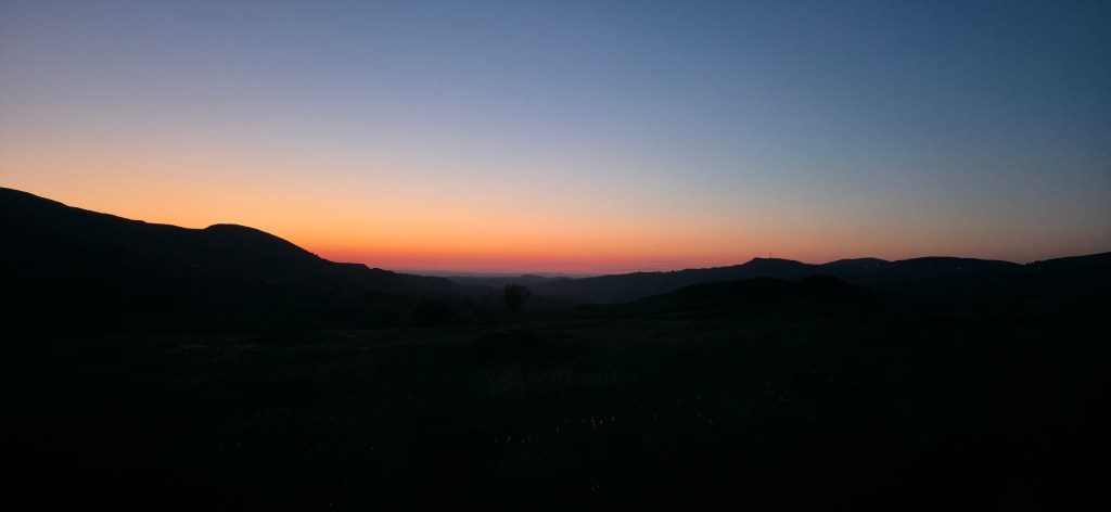
I pushed up and over the final incline and joined the Snowdon Ranger Path, it was about 5KM to the finish and finally a track that was runnable. So, I packed my poles away trotted most of the way back with occasional walking breaks to help my feet. The sun had dropped but as there was little to no light pollution there still seemed to be enough twilight to not need my head torch.
I paused to snap a couple of photos to try and capture the colours, it’s never quite the same though…

The final part of the route veered back to the beginning of the Llanberis path and then followed the route that all runners had entered the park in the morning.
My wife had cycled to meet me just up from the entrance off the local road so we were able to chat a bit while I jogged along into town. Such a wonderful feeling to be met and knowing that I was only a few minutes away from crossing the line.
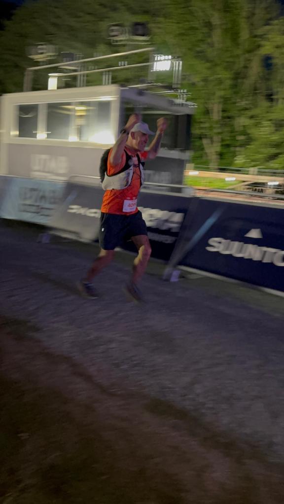
As I entered the event village and with the finish line in sight I put the hammer down one last time to run in. My sunglasses went flying as I raised my arms while charging down to the finishing arch. I was overjoyed with crossing the line.

After 56.4KM and 3400m of elevation gain I crossed the line with 45 minutes to spare before the 23:00 cut-off. What a day!
My official chip time and position : 13h 31m / 914th
Official results show that 957 runners in a field of 1178 completed the course, circa 18% DNF.
A final word about the mandatory kit list. DO NOT be tempted to remove items after a kit check. As per my story above and the collapsed runner. It was cold in that last section and that person would have needed all the items to have the best chance of recovery. The marshals do not carry spare clothing and all the kit that you should be carrying.
In January of this year I helped a runner at the Arc of Attrition who I found wandering along the cliff path. He was delirious and distressed. Mobile phone signal was weak and it took me some time to get a marshal to assist. The runner was part of the 100 mile group. His pack had little to nothing in it, certainly none of the mandatory kit that I was carrying for the 25 mile event. I’ve seen first hand what irresponsible looks like.
