
It’s all about the plan
In recent months my trail running had taken me deeper into the local countryside as I’d increased my distances and, it was a revelation to find so many new trails as well as visit new areas. I find that planning a new route is just as much fun, albeit less exhausting, as running it so with all the recent cancellations and postponements of events this year I decided to grab my map to see if I could plan my own challenge.
So there, overwhelming the dining room table, was an unfolded 1:25000 OS Map of the local area. I set about reviewing the recreational footpaths that were labelled, some had historical references while others were disused railways. My eyes tracked footpaths and followed bridleways with some leading to nothing more than a dead-end or looping in non-sensical patterns. Then I happened upon the Stour Valley Way, a marked path 64 miles long tracking the River Stour from its source to the coast. A river that in fact passes only a few miles from my own house. Further research from the internet provided insights into the route, the towns and the gradient along with many photos. This seemed the perfect thing to do and 64 miles broken into sections would be eminently achievable. The question was, “How many parts should I break this down into?”. I would, of course, need assistance with getting to the start of a section and didn’t want to put too much burden on my wife so decided it would be best to break it into 2 because running it one go is way out of my reach.
Breaking this into a 2-part trip meant I’d need to factor in the careful planning of fuel stops. I’d be carrying water and food but not enough for an entire section and, I thought to myself, “Why do I need to carry everything when local villages and towns have stores anyway?”. It seemed like a good idea. Plotting these villages and towns also meant I’d always have a get out point should I fatigue or hurt myself. That too seemed like a good idea. My plan was evolving well.
Rest breaks would happen naturally as I’d planned to photograph my journey, plus I didn’t set myself any time constraints so I could immerse myself in the experience rather than being a slave to my watch.
Part 1 – Stourhead to Blandford
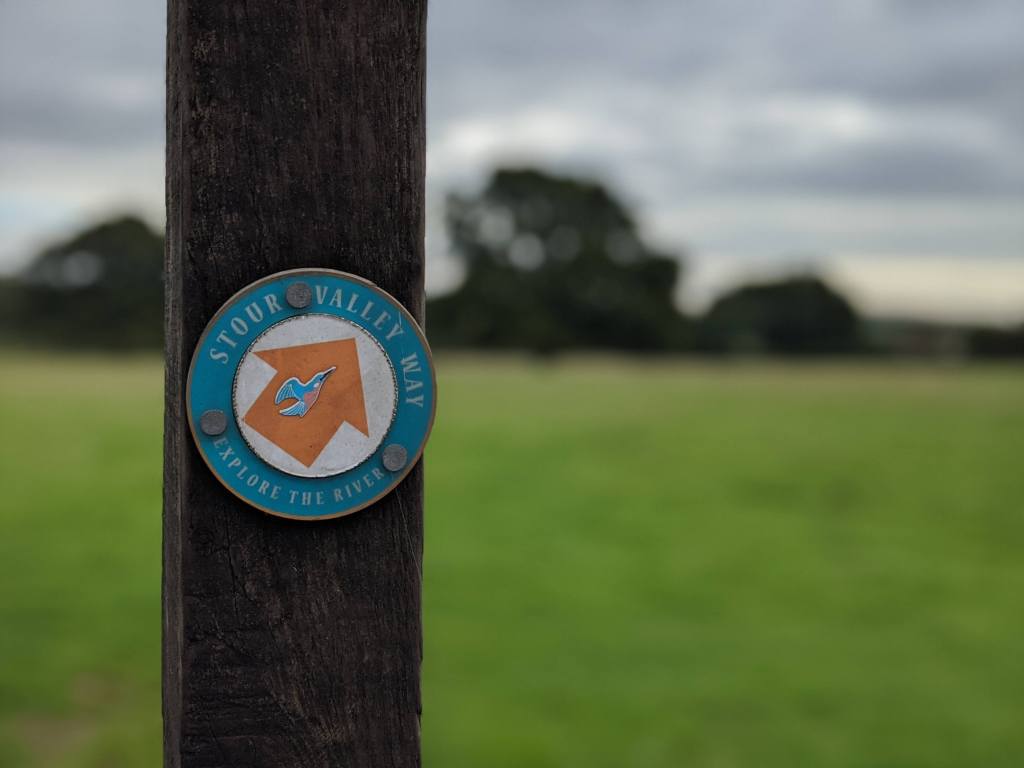
First off, I will use the abbreviation SVW in this write-up rather than keep typing Stour Valley Way and it’s not my intention to provide a step-by-step account but cover parts that stood out for me.
Setting off from Stourhead was a little confusing to start with as the “trail” starts on a road, there are no signs indicating this or, in fact, where to go next. This was the theme for most of the day.
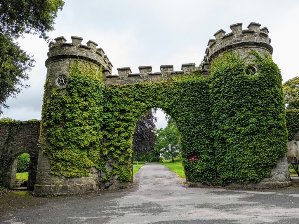
So off I started heading straight into the estate, so very true to English heritage too.
One thing that immediately struck me was the lack of signage, initially, I felt uncomfortable as I couldn’t understand where the path was, should I be aimlessly roaming around the estate? I had a digital version of the OS Map with me and sure enough, I was nearly on track but within minutes I was unsure of my route. Back out again with my map to find the SVW path.
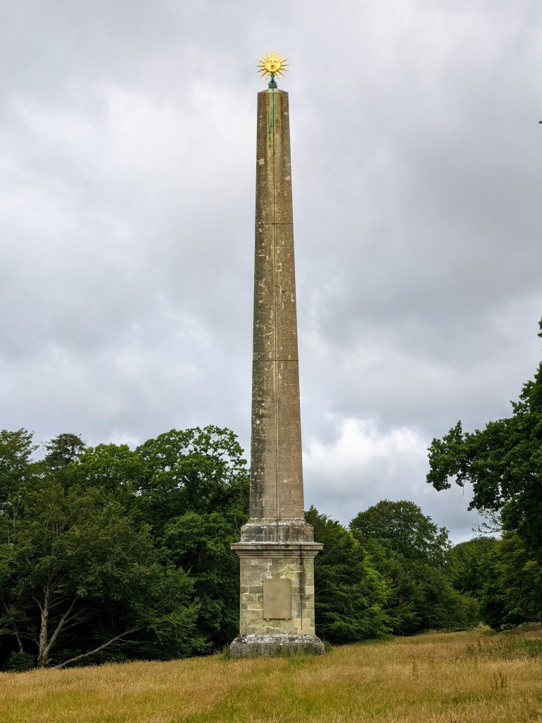
To the left of the route was this spectacular piece of stonework for which I couldn’t resist a detour. In fact, I kept to the left of the obelisk and followed a track, it passed through a gate and opened into an access path. I recommend following that route as you’ll get glimpses of some of the larger waters (which are very pretty) before joining the SVW again, it’s only about 100-metres deviation too.
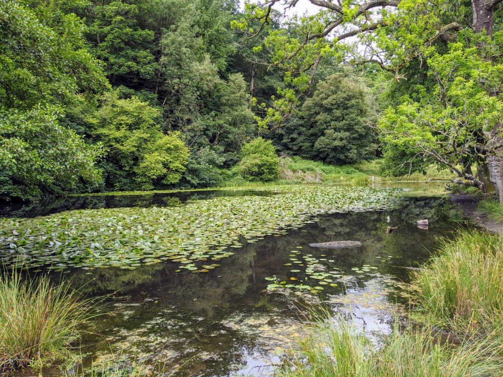
Down at the water I felt like I was on my way only to then find I was presented with a steep hill, and it was steep. As in, walkable but a lung stretcher.
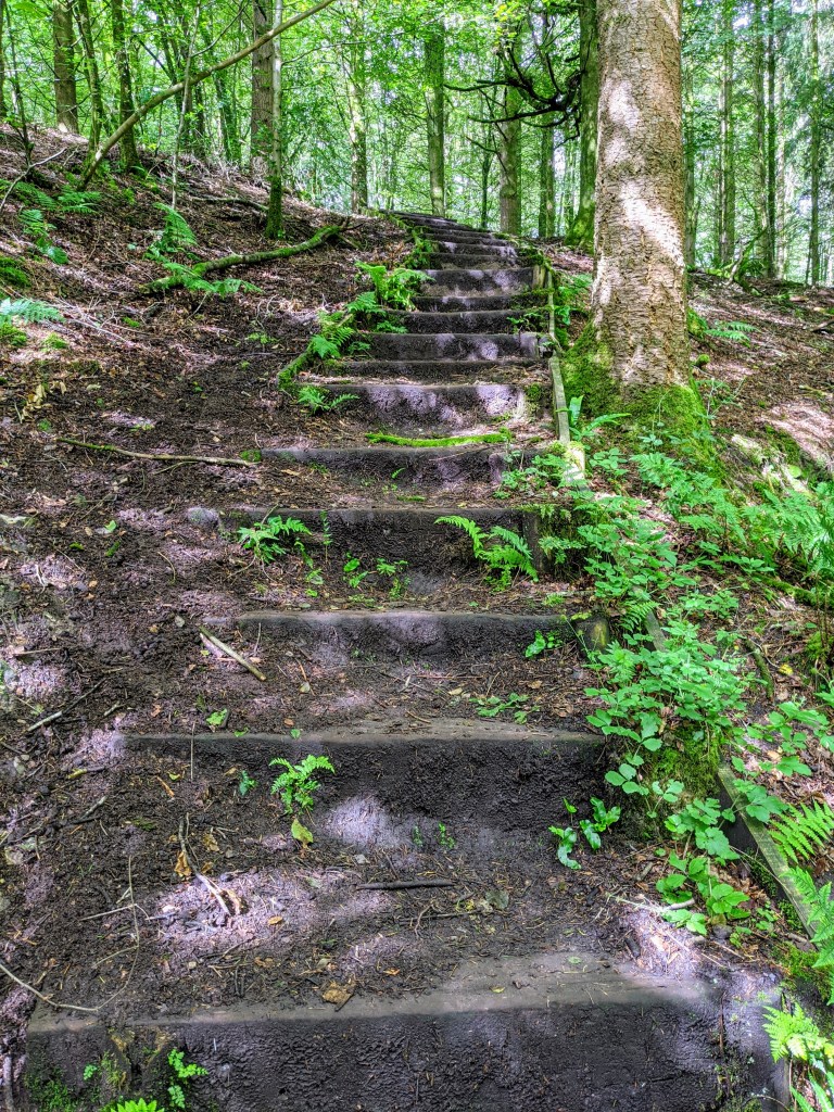
At the peak, it was the reverse but without defined steps so ‘baby steps’ were needed so as not to slip and slide my way to the bottom. Out of the woods into the open, I set off across a large meadow following a trodden route only to discover than I actually had no clue where I was heading. Back to the map and with a little course correction, I picked up momentum again but began to wonder why I was heading away from the water.
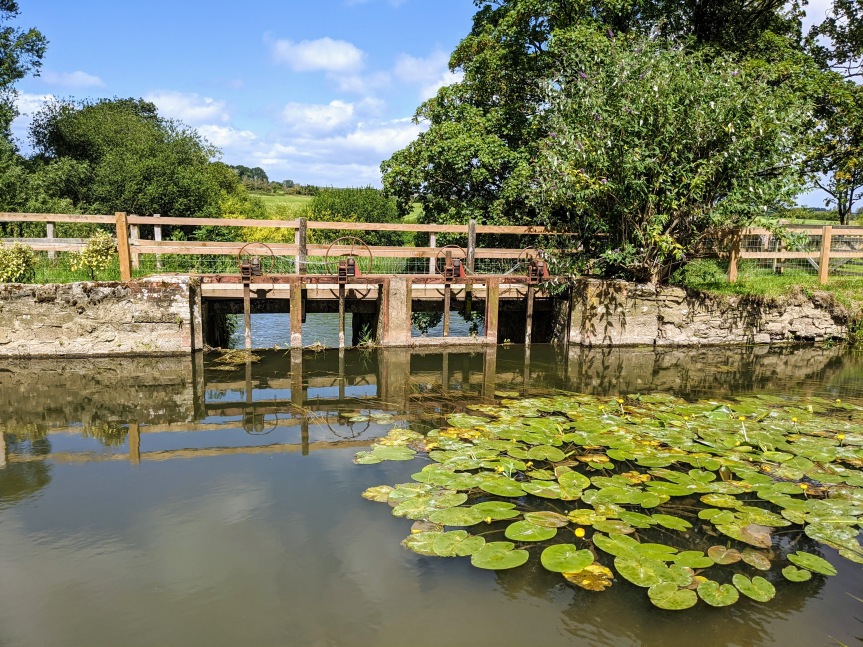
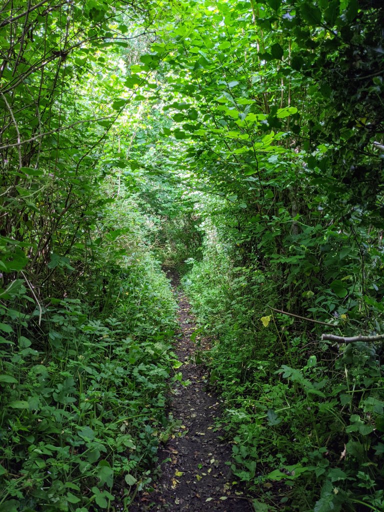
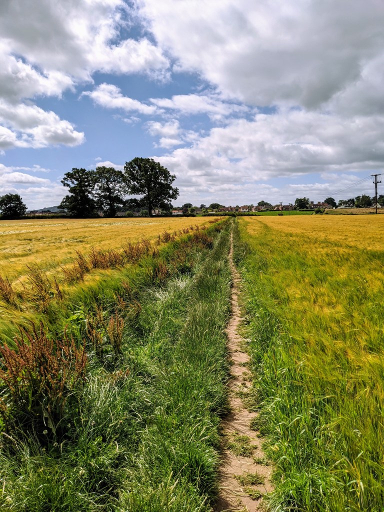
The SVW has multiple personalities, one moment you’re on a track, the next a road, a field, an old fort… The list goes on. Within only a handful of KMs under my belt I’d traversed all manner of terrain and soon discovered that the route isn’t entirely easy to negotiate. Take this path as an example, it looks OK in this picture but for someone of my stature and wearing shorts nettles and brambles soon woke me up!
That sums up the first 8 or so KMs and I can honestly say I was a little despondent. The constant map checking and getting lost, map reviewing and having random signage wasn’t what I expected. That said, I persevered and found a new rhythm accepting that map checking was simply what I had to do. Now over that hurdle, I started to appreciate what I was achieving with every step.
As the KMs passed I breezed through the countryside, at one point having to traverse the (always busy) A303 having to literally run across the dual carriageway, nestle between the safety barriers then dash to the other side – I don’t think my fast-twitch muscles have ever been put into action that quickly. It reminded me of my youth and the old arcade game, Frogger.
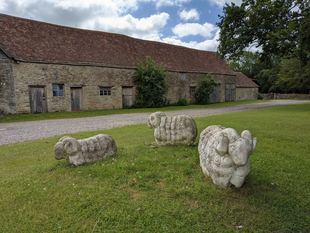
Then there are the random things that you find along a run, take these stone rams for example. 🙂
More delightful wheat fields meant there was less need to be a slave to the map.
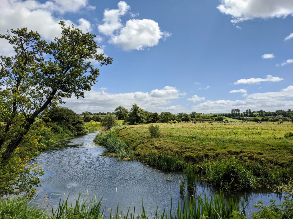
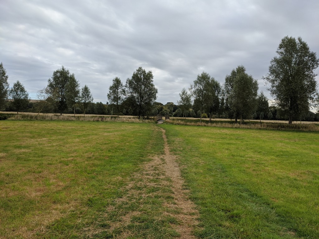
Away from the dense and hilly countryside, field after field followed with no conurbations remotely visible. Stereotypical English villages came and went with opportunities for resting in the shade, refuelling and stocking up from the local stores. The river made more appearances and in all its splendour, no longer was it the small trickling stream that I hopped over hours before.
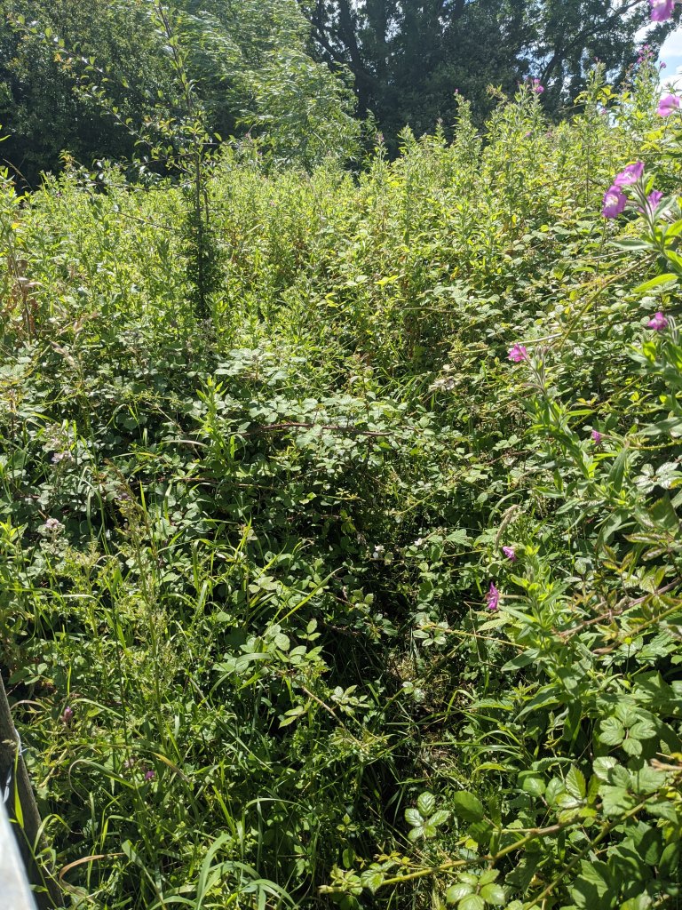
Alongside the river, cattle grazed and the sun shone, this was exactly what I had expected and I felt I’d earned it. Not less than an hour before I’d been charged at by a young bull, twice – picture me dashing and leaping over a gate like a clown 🙂 – only to be told by nearby residents that I would be OK if I, “…just stood your ground”. Errr, no thank you. And, of course, battled through more overgrown paths and stiles – and yes it stung a lot.
In spite of the randomness of the journey, stinging arms and legs, scrapes and bites (from flies, not cattle) I was still smiling.

I was acutely aware that the constant use of my phone was hammering the battery, significantly. I kept the phone in ‘Flight’ mode whenever possible, however, upon arrival into Child Okeford my phone was showing 6% battery. Following my ‘Boy Scout’ motto of “Always be prepared”, I dug out a spare battery pack and began recharging my phone while resting for a short time and refuelling myself.
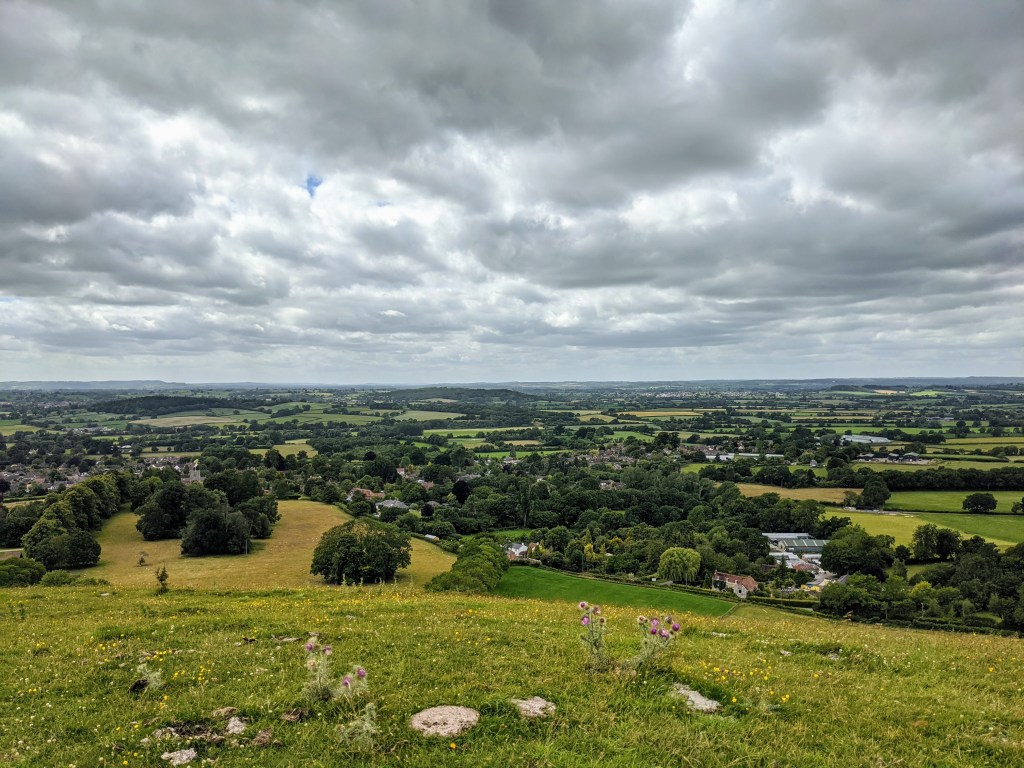
With my phone slowly returning to life and my body happily digesting its feast I faced my hardest and sharpest elevation gain, Hambledon Hill. Standing at the foot of the hill looking upwards I couldn’t make out the entire profile. An information board with an accompanying map outlined points of interest and the SVW was clearly a direct up and over, darn it, so off I set up the hill. Another lung buster. The highest point around in the area and for some miles too, topping out just over 190m high. At the top, the views and strong winds are impressive offering a true 360-degree perspective of Dorset.
Following the ridge and heading deeper into farmland the sun returned with the gusting winds now replaced by more gentle cooling wafts, the crops whooshed alongside me as I ran. That bubble of happiness soon was replaced by a steep chalk surface decent to a local road, all that height lost in moments, only to find the path ahead was directly up Hod hill. Another lung buster. Arriving at the top and back on course I cautiously gave way to cattle based on my earlier ‘clown jumping’ moments, but these seemed not to be bothered by my tip-toe walking
The KMs were still ticking away and by the time I reached Bryanston, not far from my planned finish, I was getting low on energy. I continued to keep my fluids up and slowly chewed snacks to give me the final push to boost me enough for the final (steep) hill in the Bryanston School grounds – that certainly was a walking hill for me.
Arriving in Blandford I grabbed a sugary drink from the local supermarket and sat in the shade marvelling over my day and importantly, content that I hadn’t broken myself. Yes, I was tired but I could still walk around and function and actually fancied a beer.
So here are the statistics for this first half run:
| Elapsed Time | Total Distance | Elevation Gain |
| 7 Hours & 23 Minutes | 52.77 KM | 874 Metres |
Needless to say I slept well that night.
Part 2 – Blandford to Mudeford
It was a conscious decision to leave this leg of the route until the height of summer passed. Although in the UK that typically means two weeks at some point in July and early August :-D. As the temperatures had dropped recently, around the mid-teens (celsius), now seemed as good a time as any to lace up the shoes and get going.
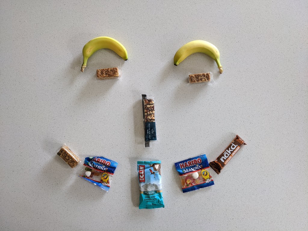
Based on the learnings from the first half I filled up the running pack with food and a portable battery for my phone. A random mixture as you see but covers my main areas of ‘on-the-go’ nutrition excluding water, of course.
A quick few (self-conscious) stretches next to the Tesco petrol station at Blandford St. Mary while my Garmin sync’d with the satellites then I was off. Initially, the first KM or so tracked alongside the main road which gave my body some time to warm up a little before heading back into the fields which I left behind weeks ago.
It wasn’t long before I had my map out to confirm the route as I negotiated stiles and gazed into empty fields with little idea of where I was heading. It wasn’t as though there weren’t trodden defined paths, there were, but in some instances too many due to local dog walkers so I needed the technology to confirm my ideas before wilding running off. Although that said, I did run up someone’s driveway only to see the official route sign on my left pointing the opposite direction. Ooops. Nice property though.
What soon became acutely apparent was the sections seemed longer between direction changes with fewer switchbacks and awkward navigation moments. Paths and tracks were a lot wider. More signage than the first half I’d previously run and in one area I counted three signs in around 500m. This was panning out to be less challenging than before.
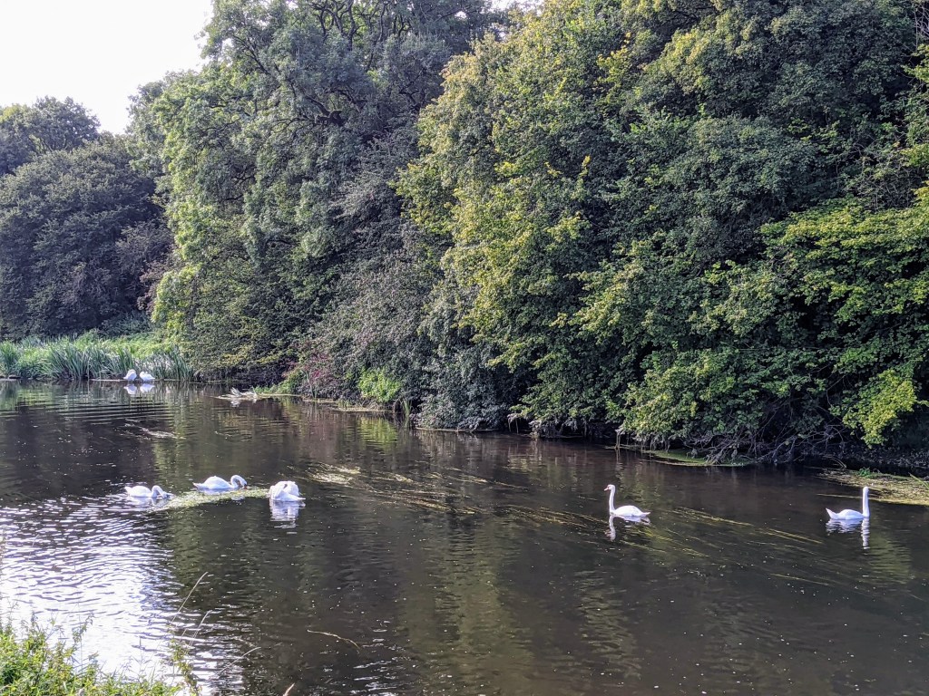
The KMs ticked on by and with less dithering around double checking my the route meant I could appreciate even more of what I was immersed in. It wasn’t long either before the river came into view and stayed at my side for quite some time. Mirror-like in many places with dozens of swans contrasting their white plumage against the water.

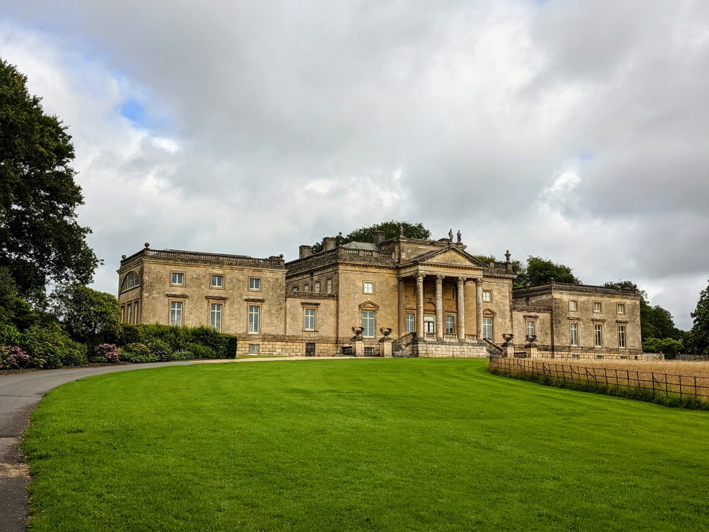
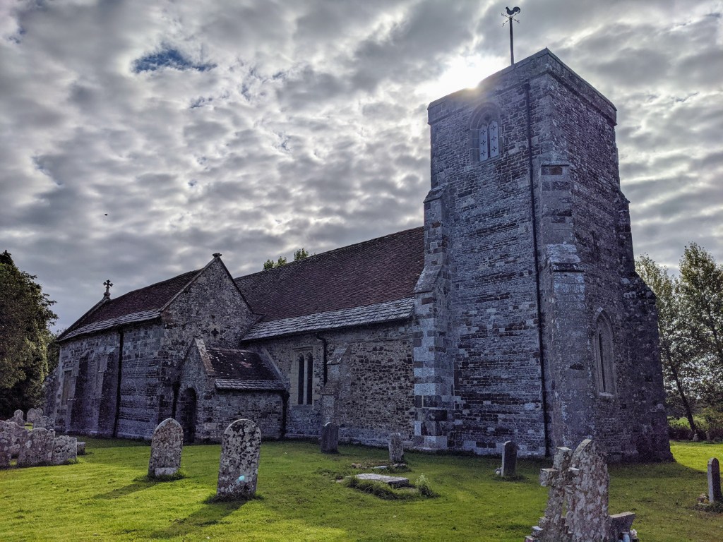
Of the many sights you get to see while exploring it’s also the quintessential aspects of the great British countryside, namely the architecture over the ages, that stand out. I love it and it reminds me we’re all so wrapped up in our daily lives that often the heritage is literally only a few miles away and oozing character.
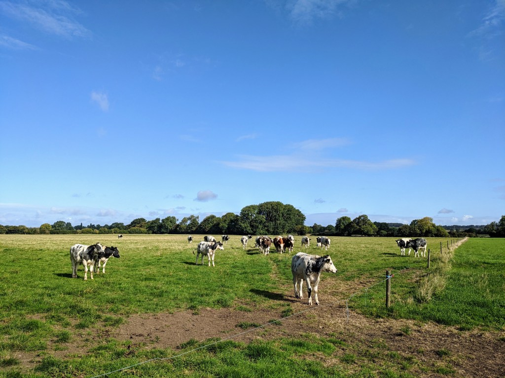
The clouds soon parted and the sun shone brightly through which, on one hand, was marvellous but on the other not great, I had no sun cream and I could feel the intensity on my skin. Oh well, it was too late to do anything about it so I just carried on my way sight-seeing the local countryside and nature. The cows in the photo below were quite inquisitive and while I kept the biggest distance away from them that I could – based on my previous experiences described in Part 1 – they began to trot behind and follow me. It was funny and slightly unnerving at the same time due to my concerns about their size if they caught me up.
Shortly after this, I was on familiar ground as I’d reached my home town of Wimborne which required fewer map checking stops as I could chart the turning points in my head. The KMs continued to click on by and before I knew it I’d already passed my local town and was heading back into the unknown.
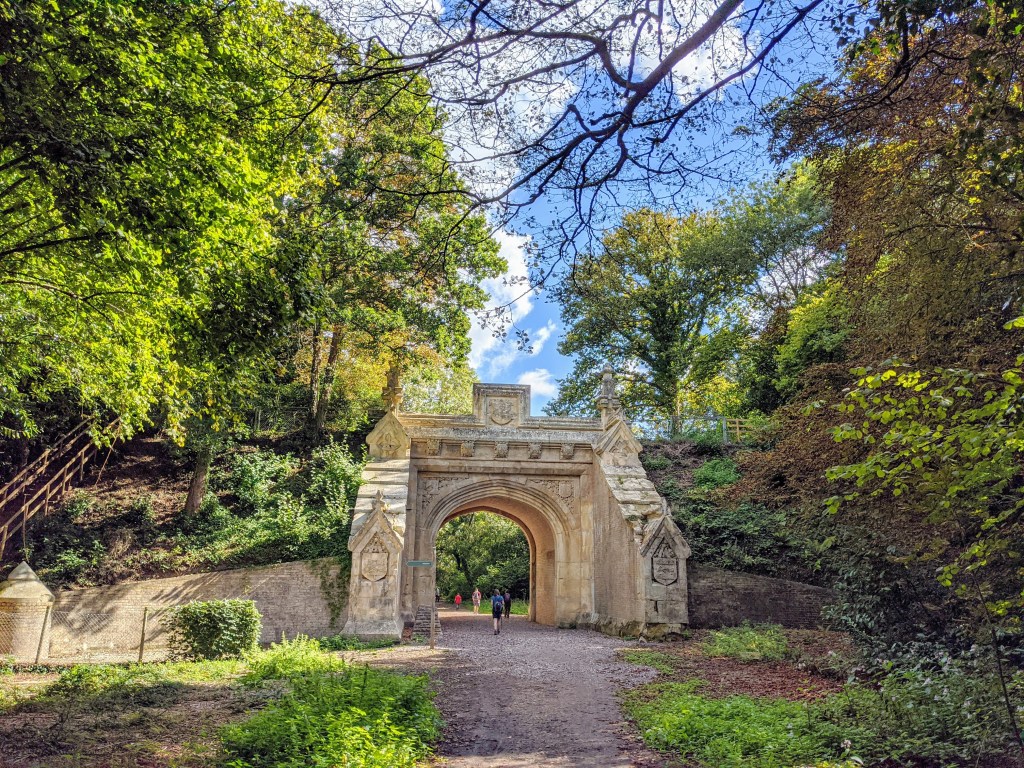
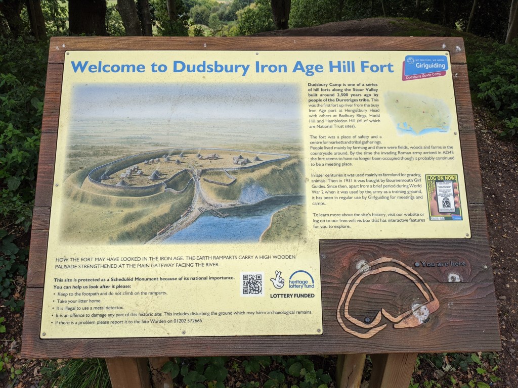
Psychologically this route really felt like it was all downhill as I knew I was heading to coast until, of course, you reach a hill that requires you to flip into a strong paced walking mode. Which fortunately only happened twice. The first rewarded me of views of the river and the direction I’d just arrived from plus the learning that I was on the site of an old Fort. An area I’ve driven very near by ever since, well, I could drive.
What goes up must come down, as the saying goes, which applied to me as I traversed smallholdings and paddocks arriving at a main road before heading back to the river and hugging it for many miles. The terrain was easy to negotiate, the signs were obvious and other than swerving around walkers and fishermen there was little map reading required.
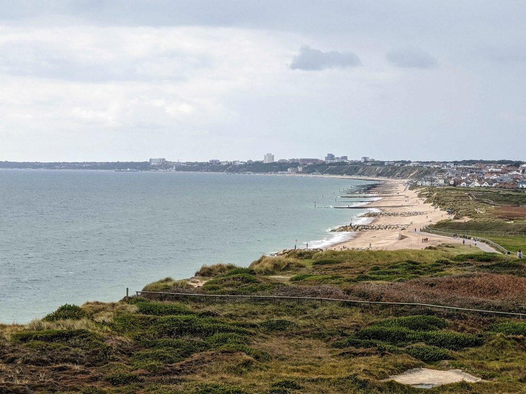
Shortly I arrived into the Bournemouth area, crossed over the A338, using a footbridge with large signage proudly announcing “Welcome to Bournemouth” to arriving motorists. A bridge I had always thought was for pedestrians but as I have now come to realise it is actually positioned to continue the Stour Valley Way path. Past the bridge and away from the traffic I circumnavigated part of a golf course then, found a sign that directed me into it, literally. To the extent that I had to leap backwards having just headed in front of a golf tee off as a golfer took a swing. After profuse apologies, I continued across other fairways to find safety along the river once more. The signage in the golf course is quite poor so the map and assistance from other golfers put me back on course – no pun intended.
From here the route loses its peaceful nature and the serenity it held many miles before. It’s evident that housing and retail have been built around the path which has now been replaced by pavements and busy riverbanks packed with boats and people. That said, I was now only around 4 miles to the final point. I continued my weaving around people, dogs, bikes, stand up paddleboards, etc.. and soon found it to be quieter as I headed toward the Hengistbury Head nature reserve. I was on the last push and found a new spring in my step as I drew closer to my planned reward. Simply to take my shoes off and paddle in the sea to cool my feet down.
As I approached the Hengistbury Head visitor centre I could see the colourful beach huts of Mudeford on my left in the distance. The finishing line. As I couldn’t see any hint of direction from the signs I had one last map check, it informed me where I’d need to go, I looked up and realised what was to come next. The largest hill of the day, to the top and over Hengistbury Head itself. Just what you need when you’re nearing 49KM on the legs! So, there was nothing for it. Off I went. Up, slowly and on the crest I stopped for a gulp of drink and soaked in the views.
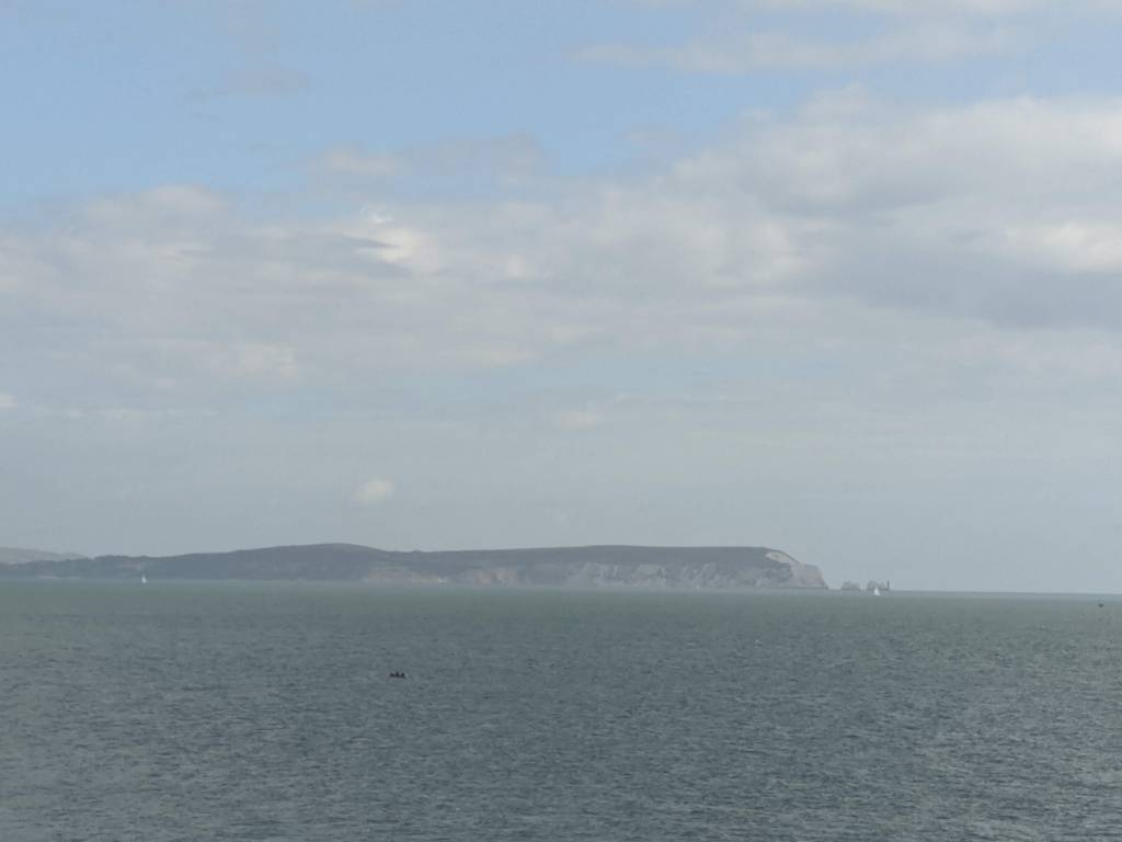
Straight ahead I could see the Isle of Wight and The Needles, a little hazy but still there nonetheless. To my right the beaches of Southbourne, to Bournemouth and to Sandbanks.
I ran the undulating top of this headland, carefully descended wooden steps (of unfathomable logic to their distance placement) reaching the beach huts. Now it was a straight line along the sand to the end. That was it, done. The 64-mile route conquered in two runs and an achievement I felt proud of.
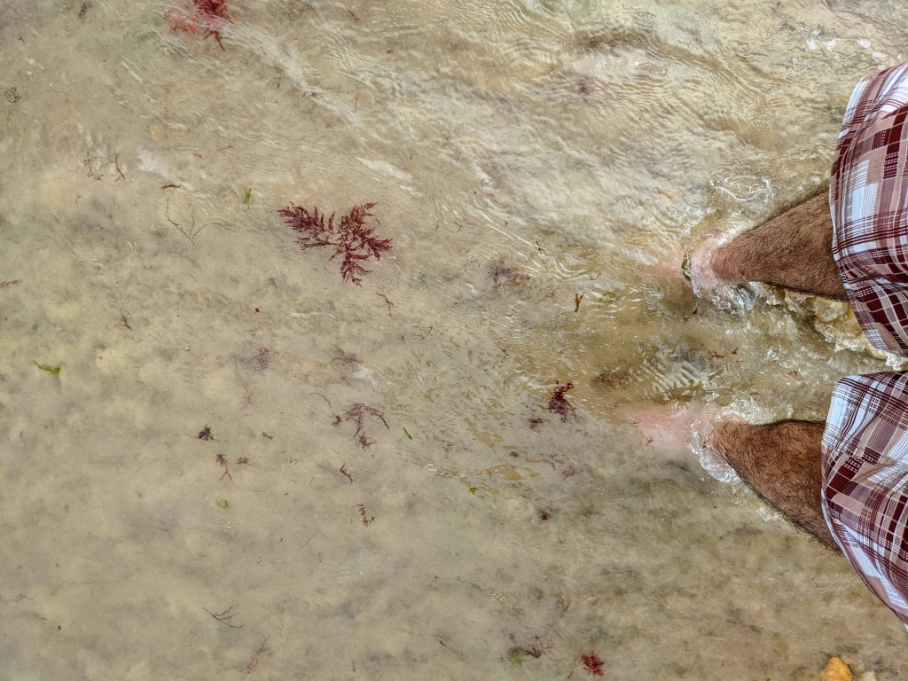
I found my way past the beach huts to the water’s edge, took off my shoes and paddled. My feet shocked into life with the sharpness of the temperature change.
I rewarded myself with a bottle coke sipping at it as I walked back to the visitor centre I’d passed a short time ago, avoiding the up and over the headland.
Here are the statistics for the 2nd half:
| Elapsed Time | Total Distance | Elevation Gain |
| 5 Hours 31 Minutes | 51.84 KM | 247 Metres |
I imagine it won’t be too long before I cook up another crazy idea like this but, for the moment, I’m quite content with my own personal achievement. At the time of this undertaking, I couldn’t find anything other than dated walking information so I hope that this write up may assist fellow trail runners keen to follow the path themselves.

One thought on “Running the Stour Valley Way”