

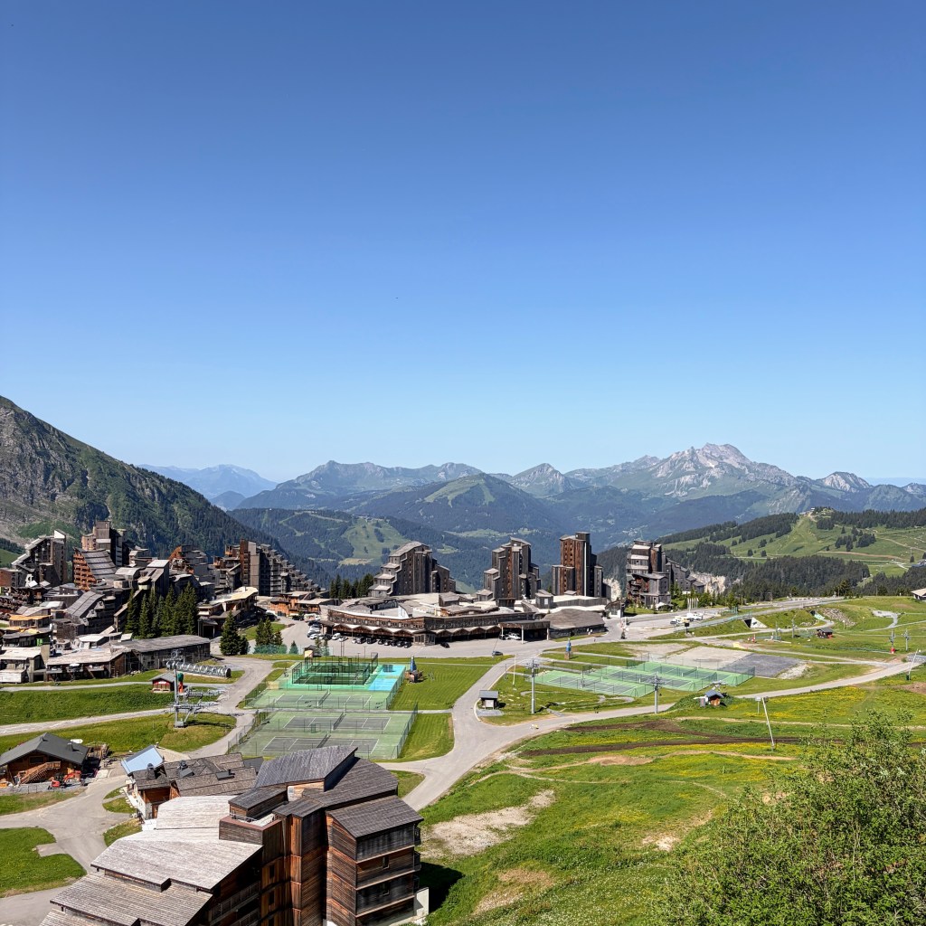
Setting the scene of the area
Since 2005 I’ve visited Morzine every summer to mountain bike and in recent years also taken time to explore the way-marked walking and trail running routes too. Morzine, Les Gets and Avoriaz have long been desirable ski resort destinations for many however, the lower altitude of Morzine (1000m) and Les Gets (1100m) with impacts from global warming has seen some challenging winter seasons for the tourist and tourism overall. The towns have been smart and over the years embraced an opportunity for summer revenue. Most notably the mountain biking has matured from guide assisted local knowledge to present day where you’re awash with fully groomed, way-marked and lift assisted trails for all abilities.
Aside of mountain bikes the walking fraternity has been provided with discounted lift pass schemes. Families have the town facilities as well as free shuttle buses to get around including and up to the local lakes. The towns haven’t stopped there. Annually the Pass’Portes du Soleil MTB signifies the entire regions lift systems to be open. Bi-annually nearly 10,000 people arrive in July for the Harley Davidson festival – it’s quite noisy! The global Spartan brand has been making more appearances and this year Morzine hosts of the Ultra World Championships. Le Tour De France and Le Tour de France Femme have been through. Triathlons and now trail running races are appearing in the calendars and it’s a trail race I’m about to share with you.
If you’re interested to learn more about Morzine follow @morzinesourcemagazine on Instagram – the team are always sharing valuable insights and information.
Race route
Runners had the choice of 25KM, 50KM and 100KM routes. I signed up for the 50KM with approximately 2700m of accumulated height gain according to the Strava and GPX information provided. After careful review of the route I felt comfortable with what I’d be getting into given the recent years of exploring on two wheels and two feet.
Here’s the 50KM route and elevation profile.
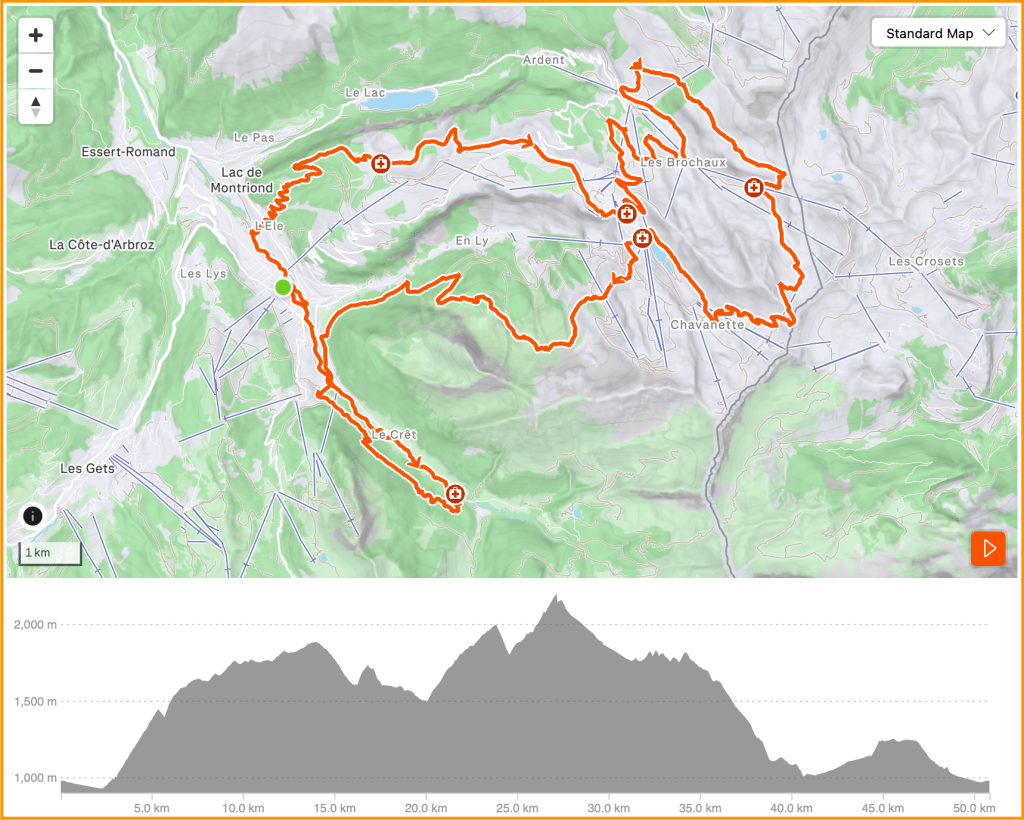
Click the direct link from the organiser’s website if you want to delve further. (opens in a new tab)
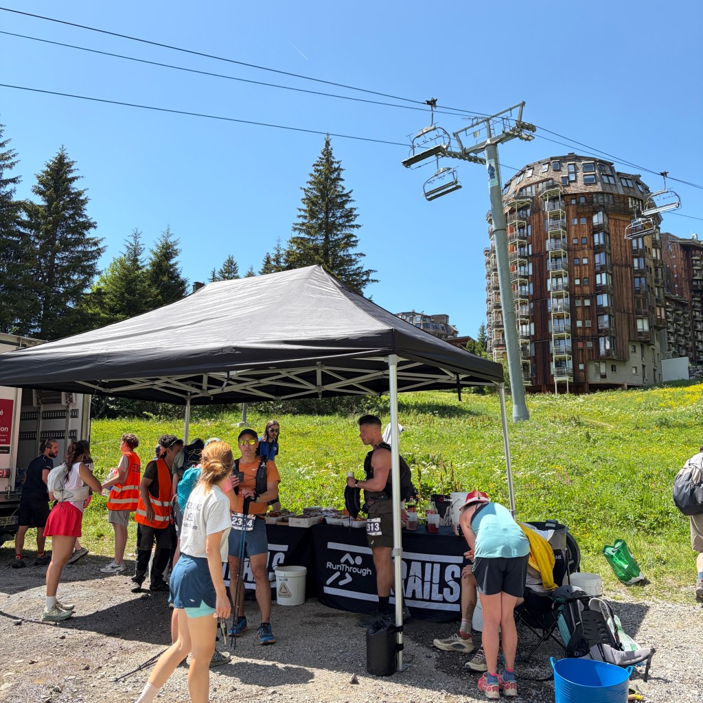
Race day -1
Registration day and it was predicted to be hot one too. Registration and the race start/finish were located in the town centre at the Tourist Information. To get ahead of the heat I got there for 09:30 opening. Prior to sign in a kit check was conducted and due to the anticipated high heat conditions every runner was scrutinised for their water capacity carrying capability. I signed in to get my race number and collected a GPS tracker. All very efficient and done within 10 minutes. I had hoped to browse the event village of sponsors after my registration but they hadn’t arrived and even by 3pm only two had appeared. Oh well, no doubt I saved myself some money.
Race day
A short 1KM walk from the apartment to the town centre was sufficient to get my legs and feet moving. Race briefing was prompt at 07:45 before the 08:00 start.
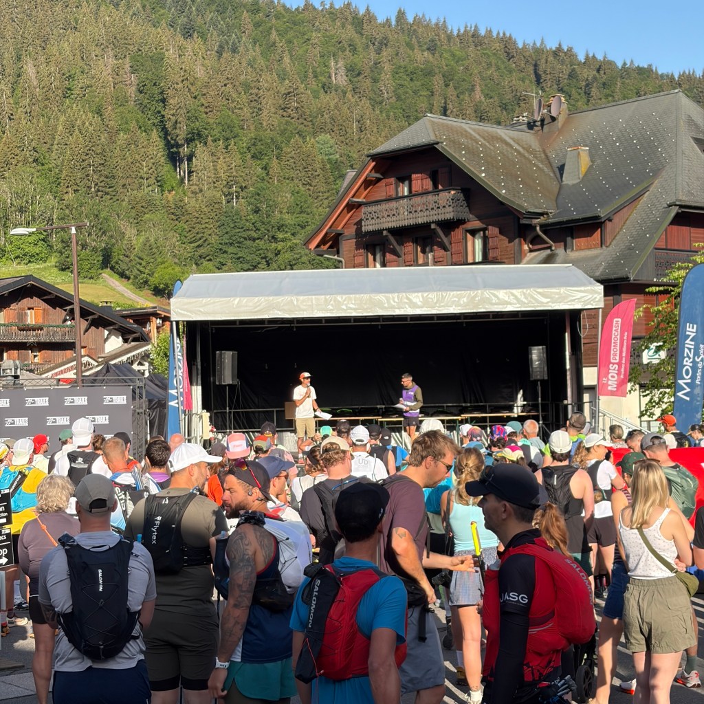
Conducted in both English in French the sponsors and volunteers were recognised for their contributions before the route markings, aid station facilities and medical assistance procedures were overviewed. With that all said and done everyone was encouraged to head to the start area.
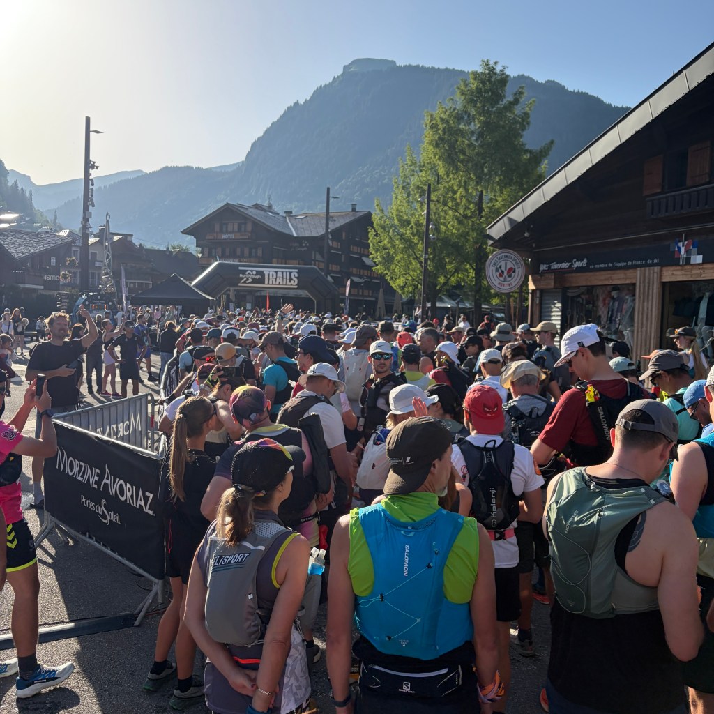
Approximately 330 runners gathered in the now very present sunshine, something that would not be hiding throughout the day. Minutes later after a brief countdown we set off. The local Gendarmerie held traffic as a herd of runners descended down Rue de Bourg. It was a little crowded and one of the local media team chose to run along the pavement to capture the descent however, hadn’t judged the position of one of the many planters used to decorate the town with local flora. There was an almighty crash, I’m not sure if that will make it into the final edit!
The route sought to track the river (Dranse de Morzine) towards Montriond.
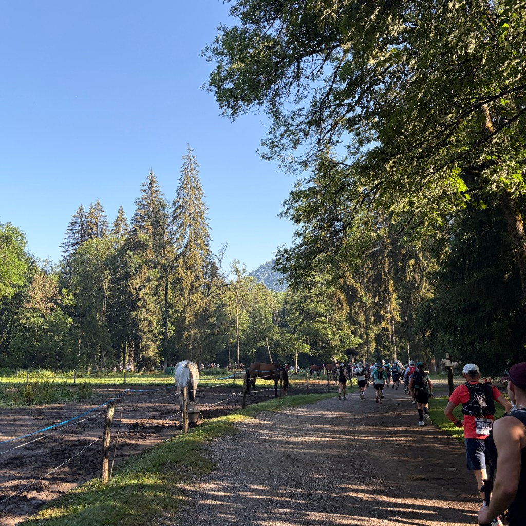
The pack of runners spread out with everyone finding their pace. Conversations were jovial as people shared introductions, where they’d travelled from and how training for the day had gone. I appreciated the early morning shade and coolness of the air from the river.
The route shortly veered off up to a road, we crossed (safely thanks to the local Gendarmerie) and headed into the first of the day’s big ascents. Fortunately, under the cover of trees.
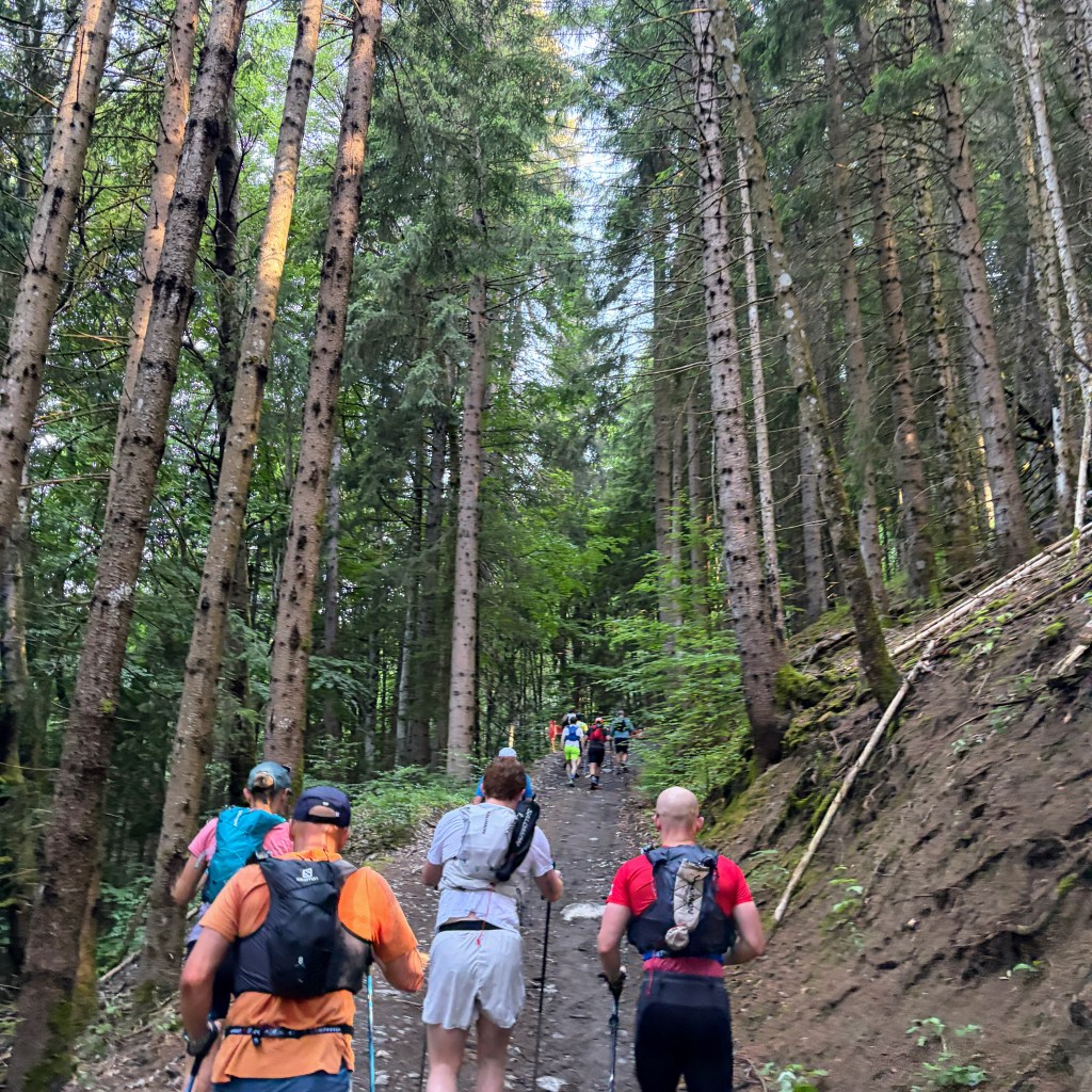
Nearly every runner had their poles out and were locked into rhythm with the exertion swapping conversations for controlled heavy breathing. This route happened to be one of the original mountain biking trails off this side of the mountain although now long redundant.
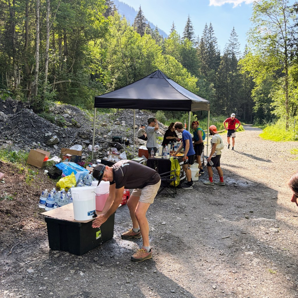
As the gradient began to level out the first aid station came into view. Apologies for the under exposed photo but you can just make out the tent!
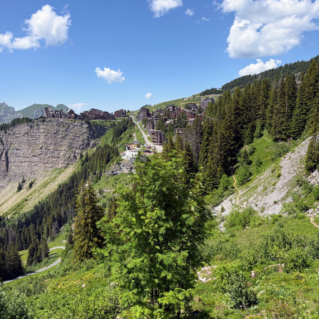
Aid station number 1, Croix des Combes, and the view in the direction of Morzine and Les Gets.
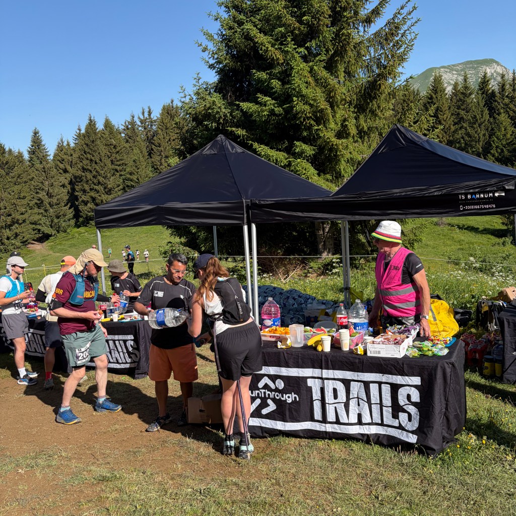
At this stage I only needed to replenish 500ml of water and raid some of the watermelon on offer. Leaving the area my watch statistics were 1h 33m / 7.6KM meaning I was 50 minutes ahead of the cut-off.
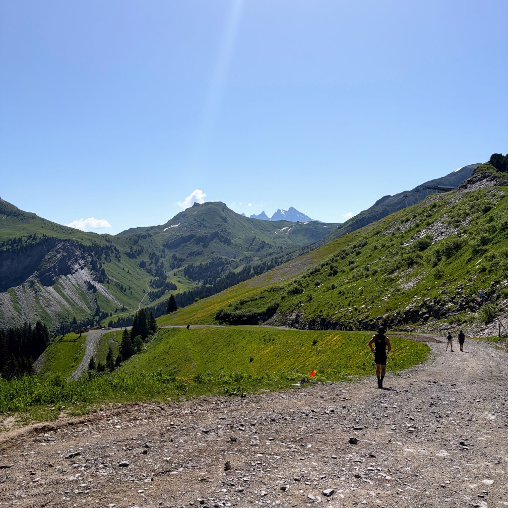
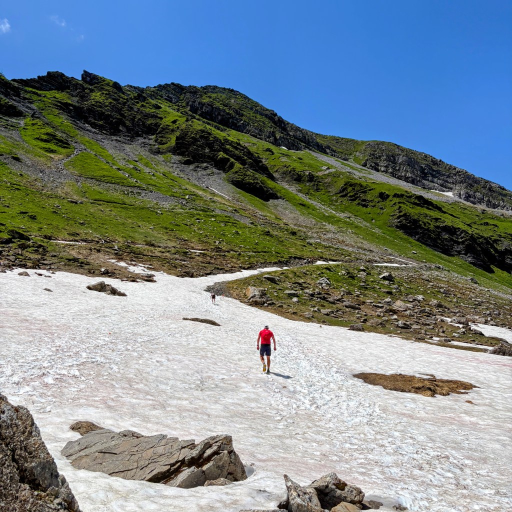
As with any route that you walk, cycle or run in the mountains – what goes up must come down – and that’s exactly what happened next.
It was a brief spell out in the open before the shade returned. The trail now took on more of the walking paths toward the next refuelling stop in Avoriaz. This section didn’t need poles but certainly needed pacing so as not to over exert on striding and burn too much energy. It was not long after passing the local golf club nestled in the shadows of the Avoriaz complex that one of the 25KM route runners flew past. And I mean flew past. Not to be deterred with my ability to maintain a slow trot I arrived into the Avoriaz village and the aid station of Base de Vie. This was delightful as it was indoors.
The volunteers were enthusiastically welcoming every runner in with a cheer and clapping. I took time to refill every bottle and hydration pack bladder, use the toilets and remove ‘that annoying stone’ from my right shoe. Why I hadn’t stopped earlier and dealt with it I do not know!
Leaving the heavenly protection from the sun my watch statistics were now 2h 34m / 13.1KM meaning I was 1 hour 35 minutes ahead of the cut-off.
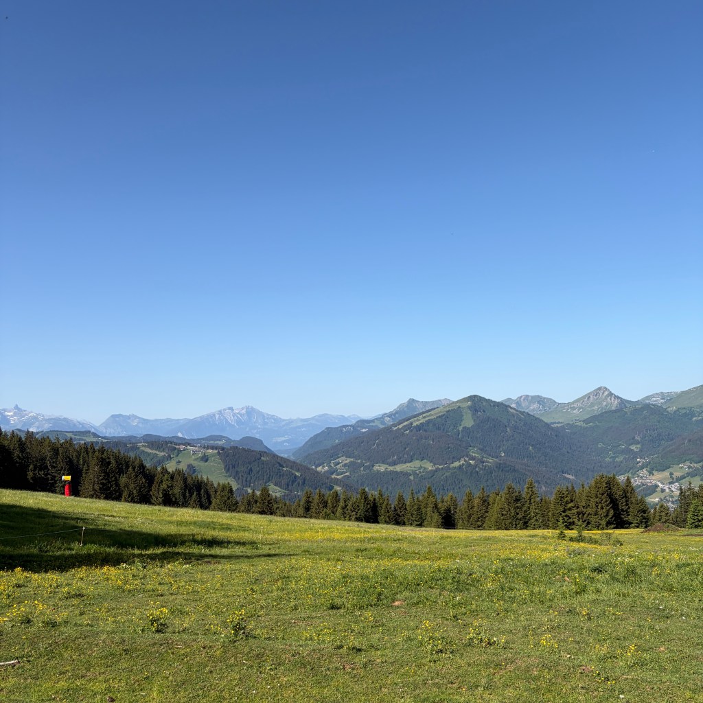
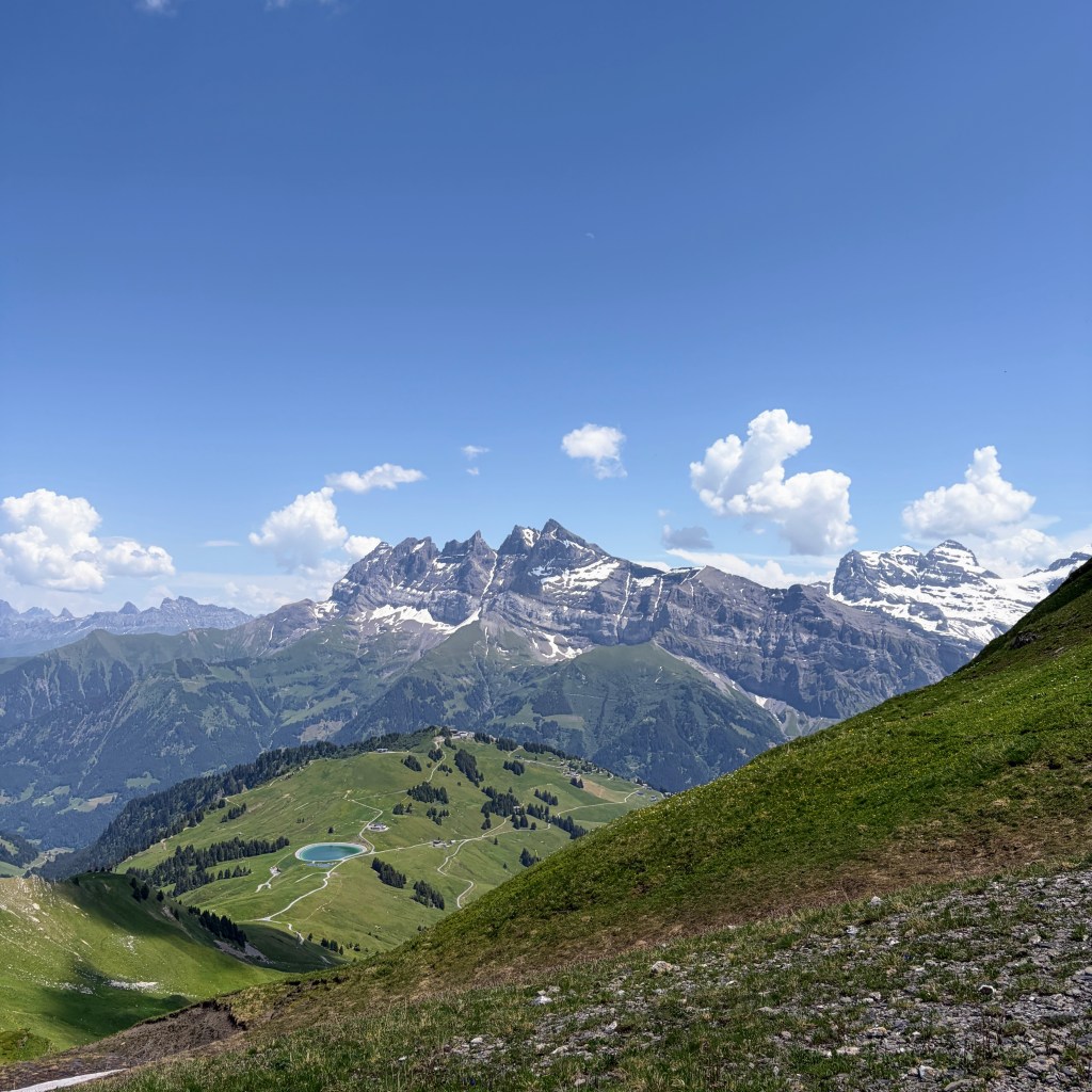
Heading up to the top of the village the view down and beyond was very clear.
I would return here later to the lower part of the village but that was a while away.
The next section was a long descent in the direction of the Les Lindarets following large piste runs that in the summer are just stone and rocks which certainly gave my feet a bashing.
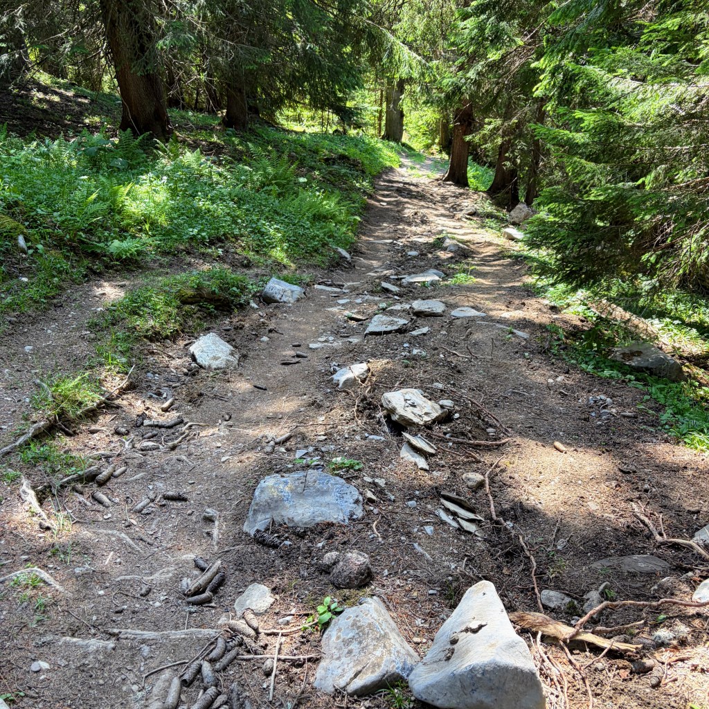
As with most photos from a mobile phone the gradient never translates but be assured, while it was run-able there times that my feet wanted to exit from the front of my shoes.
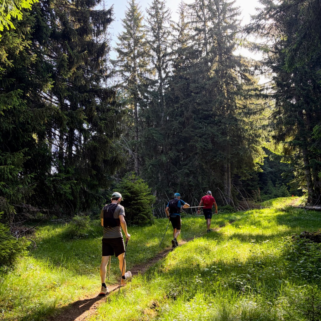
At the bottom the course joined onto one of the blue graded mountain bike tracks (Le Goat) before sharply veering up another piste. This climb needed poles and some people I noticed were beginning to need to take more breathers than earlier. The route veered left and descended down another piste but with a greater angle of degree which required more thoughtful foot placement and zig-zagging to ease the pressure from the feet.
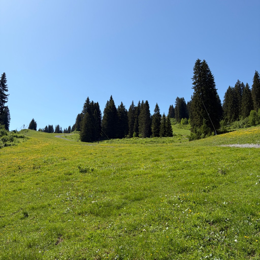
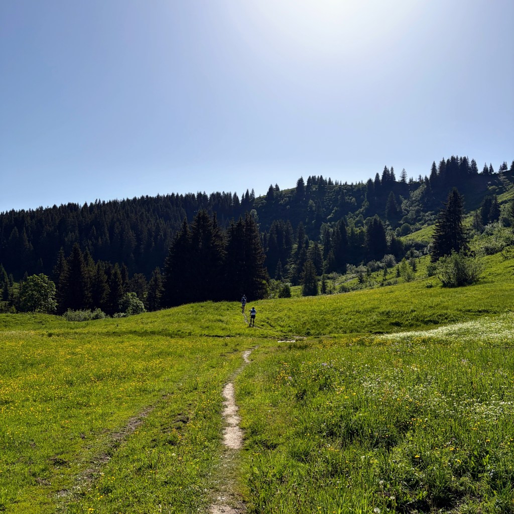
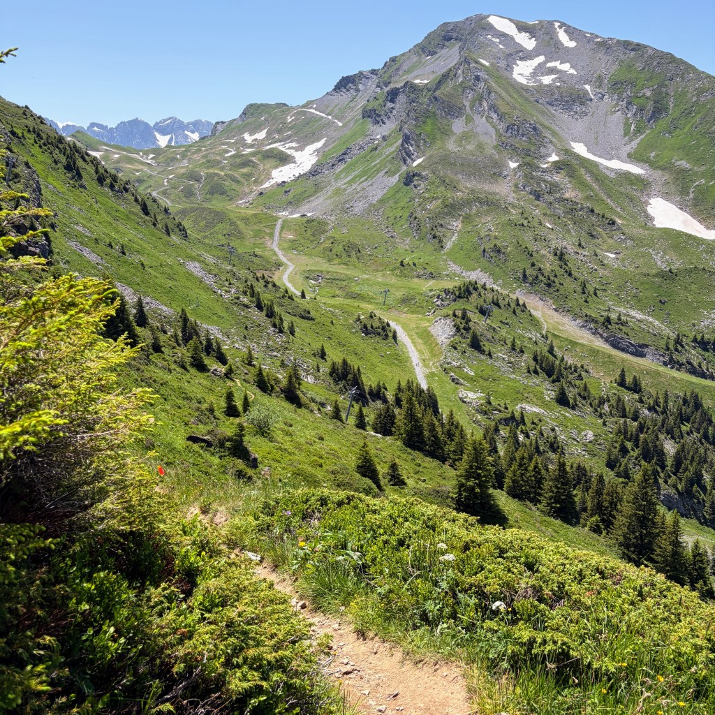
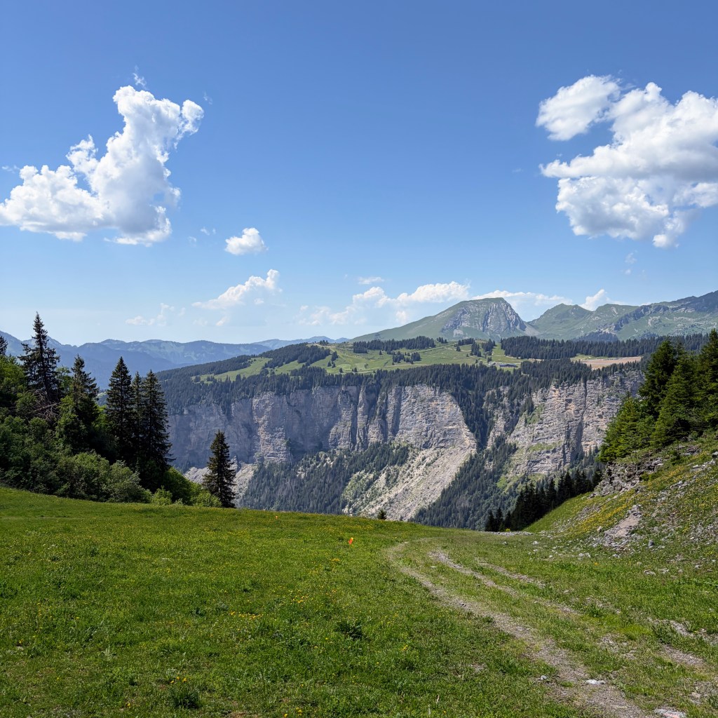
The photo looks like a rolling meadow and I can hand on heart state it was far from that!
From the point where the photo above was taken the route joined back onto a shared walking/biking path heading in the direction of the Cascade des Brochaux. This was easy running and predominantly in the shade too. At the end of the path the reward of the waterfalls was there.
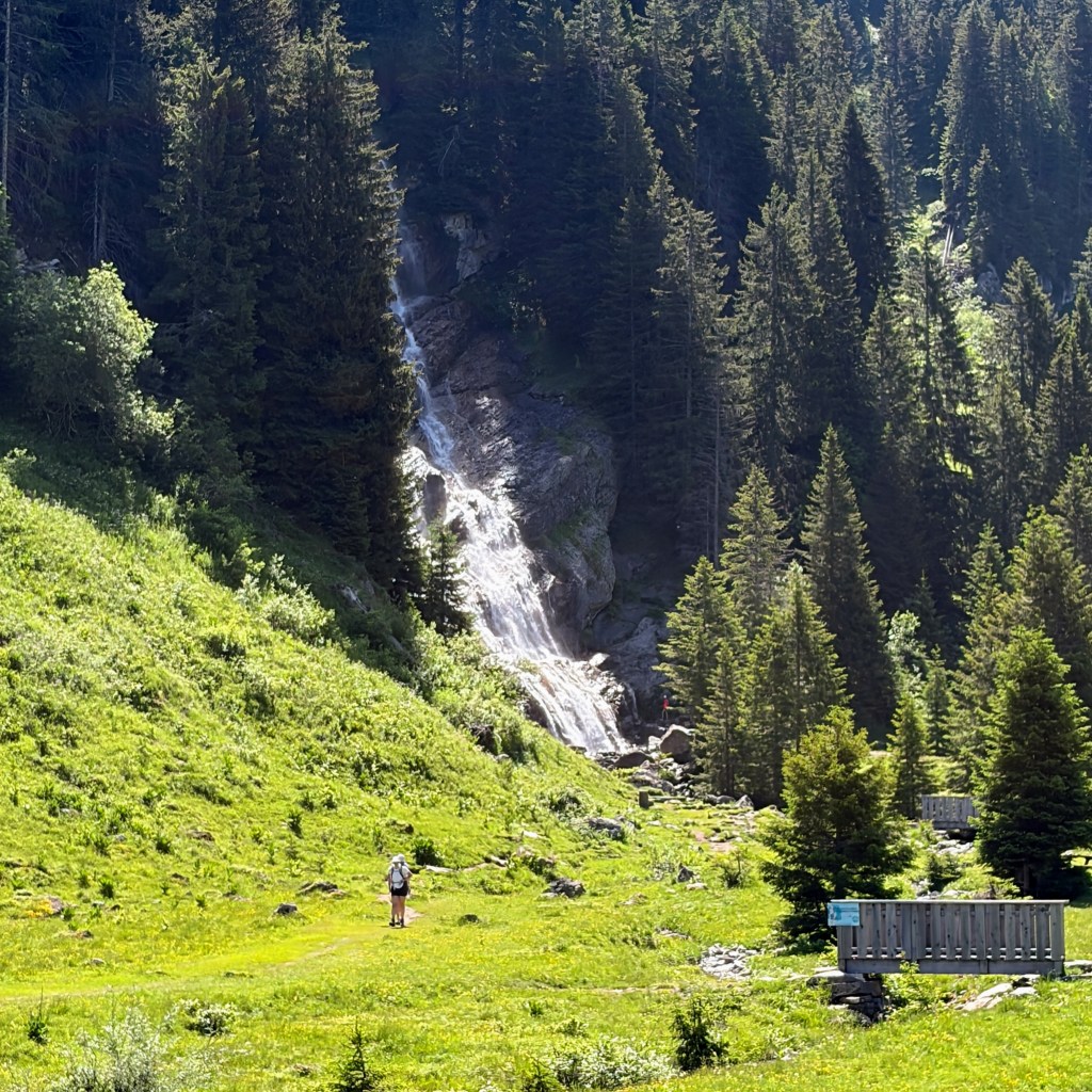
I took a brief deviation to get a little nearer but didn’t spend too much time off the course.
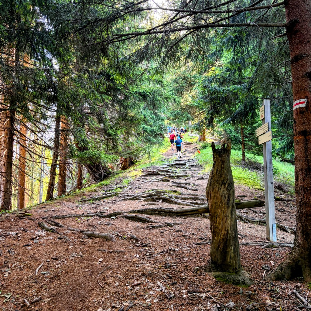
The route was way-marked back to Les Lindarets, an undulating fire road where my earlier altitude gain was slowly being eroded. Passing the Ardent telecabin the route abruptly turned right into a sharp ascent. Out those poles came and they stayed with me the entire climb up the fire road (called Choco-Peaux) to where the route joined the famous G5 walking trail. The walking trail waxes and wanes with its smooth simplicity to rock clambering complexity to dips and then climbs. The whole time the sun beat down.
Eventually the path met an intersection of others. Turn left for Lac Vert or turn right and descend to the fire road and the area of Brochaux, which is exactly where the route was heading. I found the path challenging due to the nature of it being “a path”. Think switch backs, rocks, considered foot placement drops and an odd scramble.
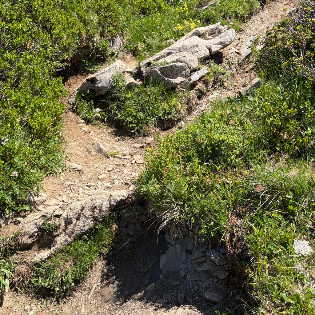
Here’s an example. Now, that drop above doesn’t look much but its height is more than my foot to my knee – and I’m 6ft 2in tall. Anyway, it’s a me problem and I’ve always struggled to negotiate terrain like this. I stopped at times to compose myself and appreciate the view.
The gravel road in this photo I knew to be the next ascent so getting my food on board and liquids replenished was a must. At the bottom of this track was the next aid station aptly called, Brochaux, official distance 24.5KM.
Coincidentally, my GPS tracker went offline at this point for an hour – as I found out later when speaking with my wife. Initially panicked by this she switched to my Garmin LiveTrack to see that I was still on the move and hadn’t tapped out.
After a pause, a chat with some runners and replenishment of my flasks and hydration bladder I set off to the next challenge. Surprisingly, it was a steep piste.
My watch was showing 5h 15m and 25KM. I was happy with my progress.
With poles in hand I stomped up the piste alongside another runner. We exchanged many stories of routes we’d run, the countries we’d visited to race in, the achievements and the realty that not all runs go to plan – and what learned. Approaching the summit of this mountain a cool breeze whipped around and simply by being on the snow it felt heavenly. Another (of the many) sahara cap dips in the melt water and moments of feeling chilled to the bone as the water rolled around and down my neck.
At the summit myself and others stopped to appreciate the uninterrupted 360 degree views.
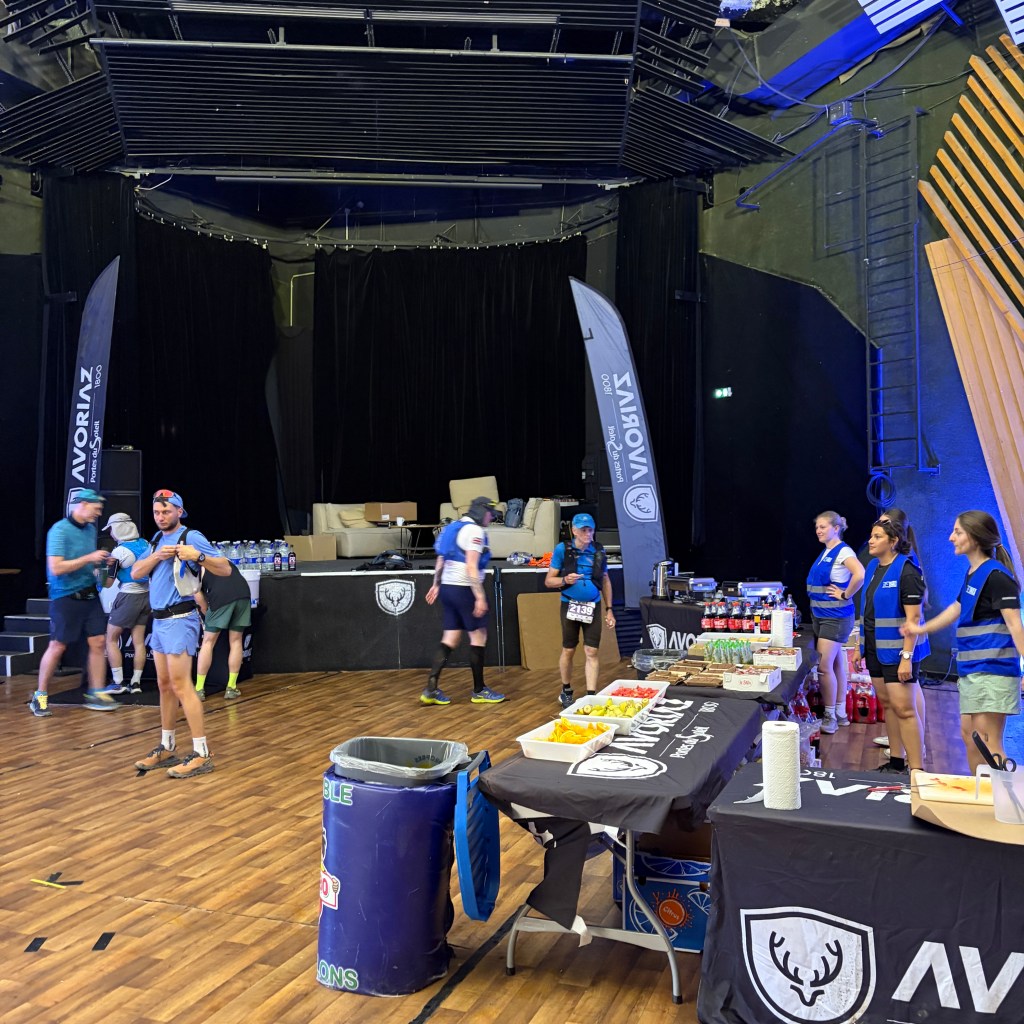
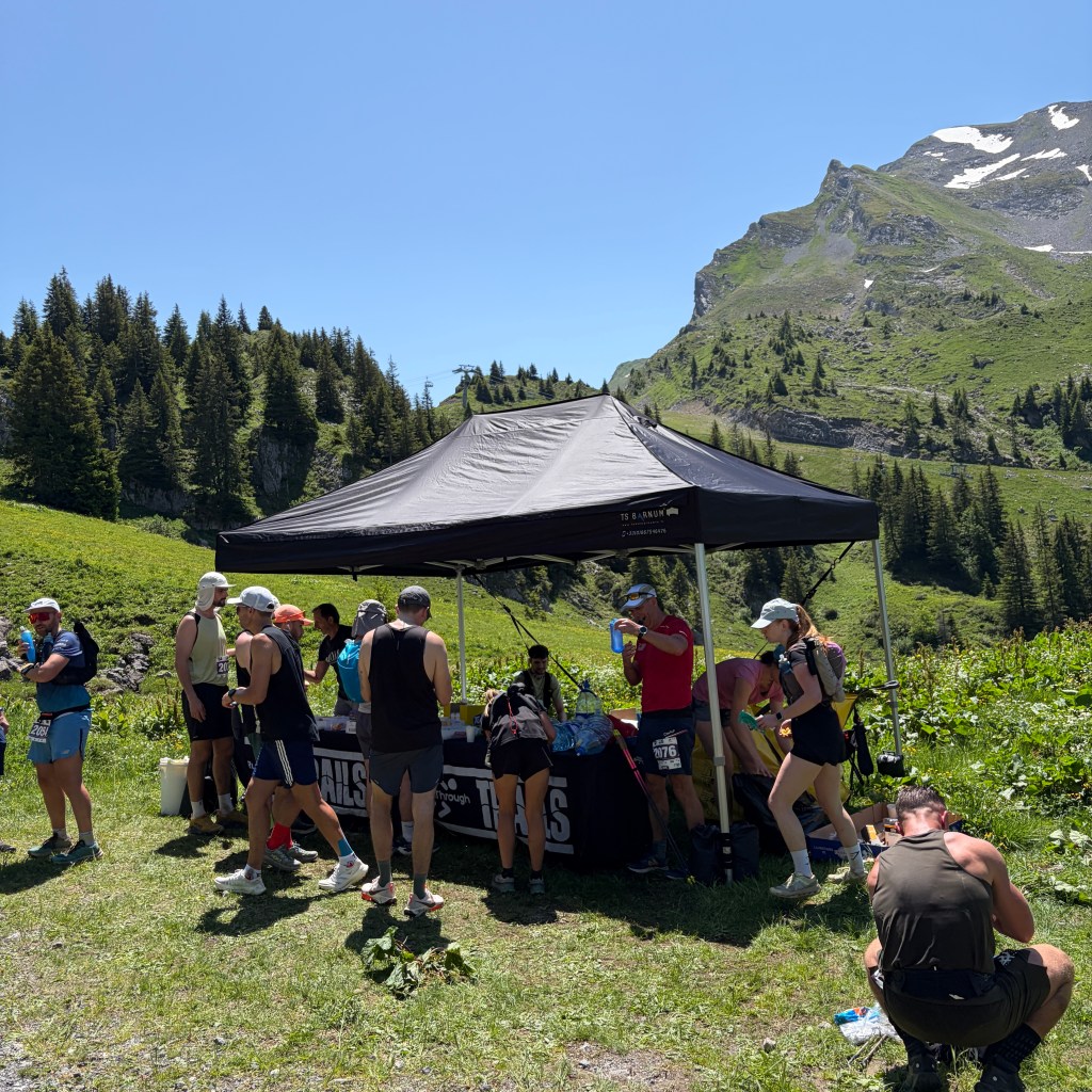
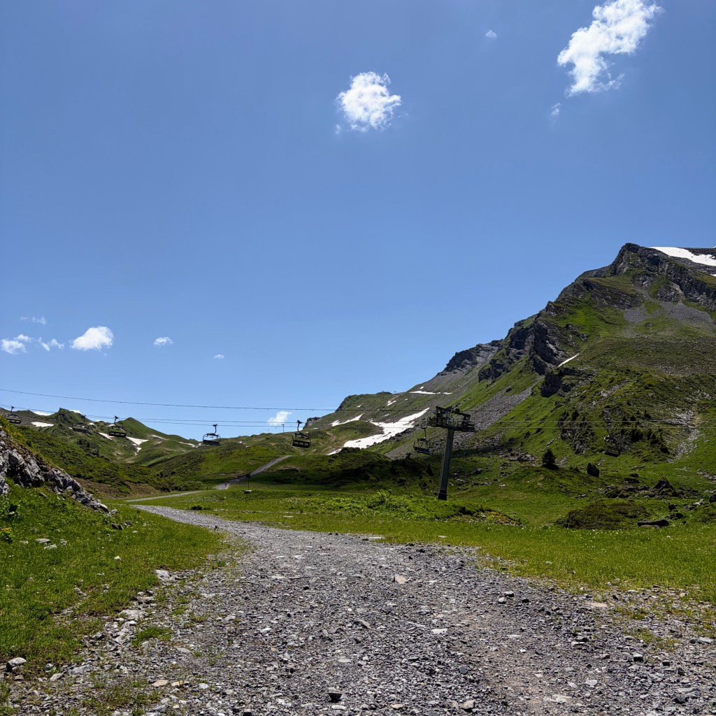
The route sharply descended along a fire road, past the Lac de Avoriaz and toward the edge of the Avoriaz village. Occasionally, a seasoned confident runner would fly by but I was happy to maintain a gentle jog. The next aid station, Avoriaz 2, welcomed me in.
Another opportunity to refuel, fill up all my water carrying options, throw in myTtailwind mix and get ready for the big descent. I was looking forward to the shade this section would provide as the route was heavily tree covered.
This aid station was officially 32.5KM of the 51KM route. My watch read 7h 5m with 32.3KM and I was feeling positive about how the day had worked out so far with managing the heat, the cooling down and my nutrition. However, fate was about to catch up and then overtake me on this next section.
The path wasn’t so much a path but my favourite style of rock, rock scrambles, rock step downs and quite frankly everything that would see me spending too much time picking my way along it. Remember that me thing I mentioned earlier? On the brief moments where a path did appear I would pick up the pace, stop and look back to Avoriaz and further down towards the Zore mountain side of Morzine.
The route was taking its toll on my sense of humour at times. It rose, it descended, then when I thought I may have been through the worst of the rock another small section jumped out shouting “surprise!”. Reaching the area of Morzinette signalled a significant change in the terrain as it was truly forest from there all the way down.
In many respects this was a mirror of the climb up and out of Morzine in the morning. Roots, ruts and rocks but this time there was no need for poles. I was able to skip down this which became enjoyable as I felt I was making progress which hadn’t been the case for the past few KMs.
The descent occasionally broke free from technical forest floor to wide tracks likely used by quad bikes. The light changed dramatically as dense cover seamlessly morphed into thinner canopies allowing rays of sun to permeate. Apart from an odd runner passing me it felt like I had the whole forest to myself.
Eventually, I exited the wooded mountainside onto a local road, Rte de la Mernaz. The sun beat down and heat from the road really pushed up toward me. An extra water station had been placed here, now it was 42KM. I didn’t refill but I made use of the water for a cap cooling moment. This is where fate welcomed me to inevitability for forgetting fuelling. I’d been highly distracted by the technical elements after leaving Avoriaz 10KM earlier then boosted by getting into rhythm again after Morzinette but all I’d been consuming was water and Tailwind. It wasn’t enough fuel for my body.
I felt wrecked, the worse I’d felt all day. It wasn’t as though I’d hit the wall (that was coming) but I’d literally run out of fuel. I tried getting food into me but it wasn’t comfortable. I’d gone past that point and if you know that feeling you know that feeling isn’t easily reversible. Such an error.
My initial thought as I left Avoriaz was that I’d exit the wooded section and run the gravel track to the aid station alongside the river then run back into town. However, while I’d run that section many times before in recent years today was so very different. I had to concede to a fast pace of walking which after a while even became challenging to maintain. The only saving grace was I was in the shade.
The final aid station, Chargeau, at 45.5KM came into sight. Finally, I could turn around and head back to the town centre. I jumped to the river’s edge, cap dunked, cooled down. Topped up my water at the aid station and set off back up the mountain. Yes, UP the mountain.
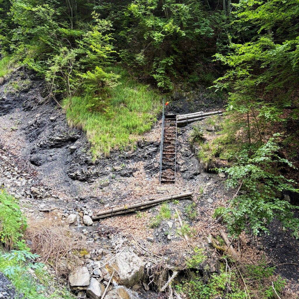
Exiting the aid station my watch was showing 9 hours 54 minutes with a distance of 45.7KM. I realised my goal of a sub 10h 30m was no longer achievable. I felt broken and the next section, while in the shade, I knew was going to be a personal battle. I dug in. I felt awful. I walked at pace. I trotted on the down sections. I sighed heavily when I saw the ladder.
I knew that once I was at the Nyon waterfalls I was knocking on the door of finishing. The path undulated and switched back and forth following the mountain’s contours promising moments of descent only to discover around the corner was another small incline.
Exiting the woods into a field I was welcomed by the sound of cows and their tuneful rhythmic bells. The green meadow, a small wooden chalet was a good place to stop. On a summer’s day stroll it was picture perfect. But I wasn’t on a stroll. I want to add this wasn’t just a stop to appreciate but now I truly had hit the wall. I took off my running pack. I rummaged through it and grabbed the cheap and nasty sugar rush of Haribo. Those gummy foam crocodiles were a challenge to chew but then absorption in the mouth kicked in and within minutes sugar brought me back to feeling better. Not hugely, but enough. I pulled on my pack and set off, I could hear the Nyon waterfall beckoning.
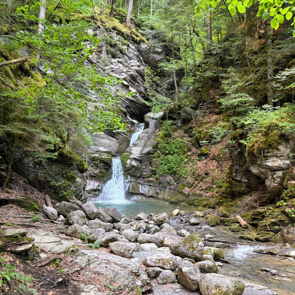
Passing the waterfalls with their cooling mist I followed the track down and I was back by the river. I felt energised (most likely from the sugar) that I really was going to complete this race. I had a couple more of the crocodile boosts and passed the fire station. Back along the river and opposite a pizza restaurant a couple seated outside were looking at me. Neither person did anything so I just put my arm and waved. Sheepishly, I think, they waved back. The reality of the town and nearing the end was near.
Ascending the Rue de Bourg, the route we’d all charged down hours ago, I could hear the loud speaker system as other runners were crossing the line. The road levelled out and I broke into a run. That finish line was mine.
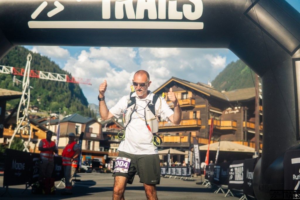
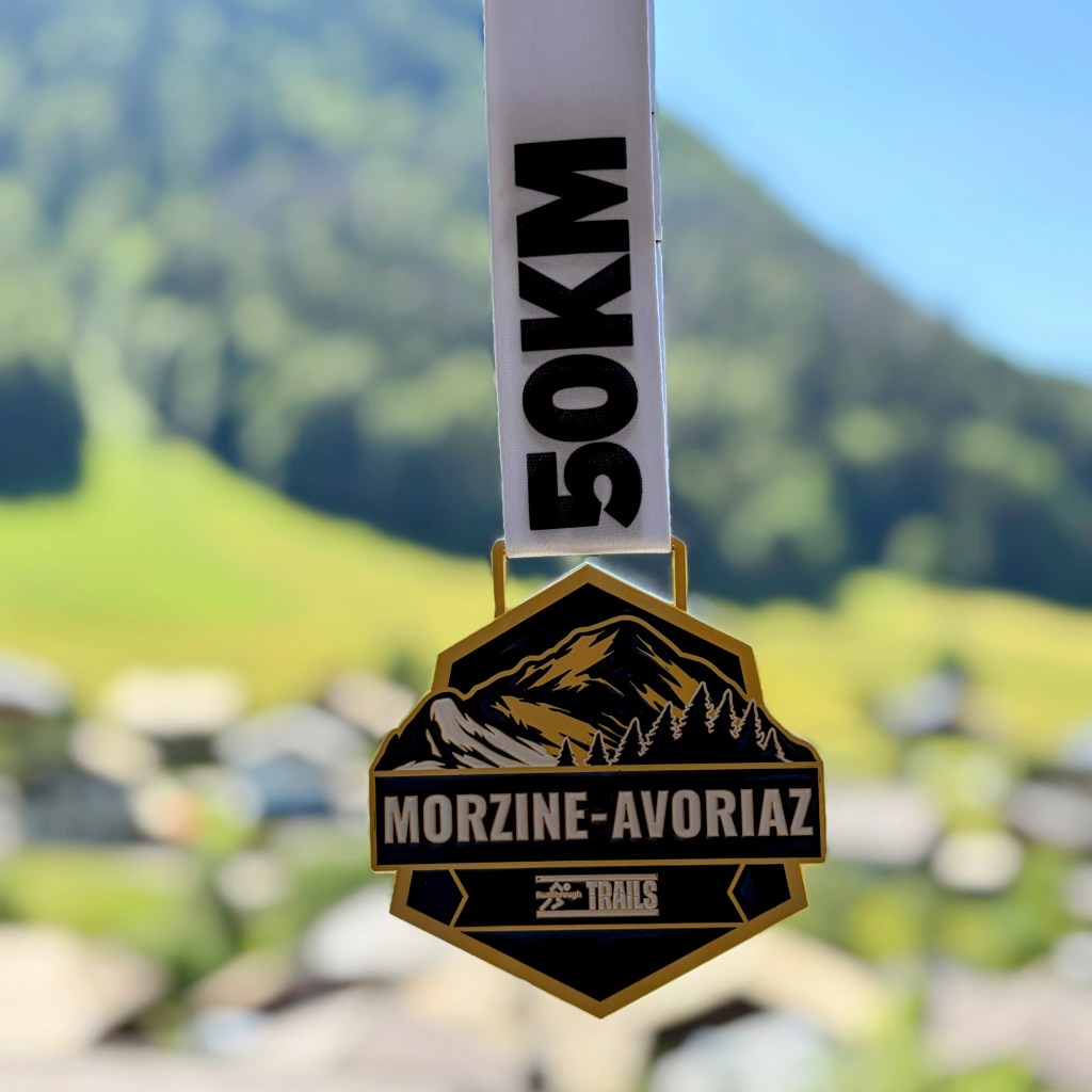
11 hours 23 minutes, 51KM and punishing heat – I truly was delighted to have a medal placed over me.
As a bonus my friends surprised me and were there to welcome me with rapturous applause and cheering. What a day.
